Warderick Wells Last Day

Please follow and like us:
The USA Flag off Warderick Wells….

Tomorrow we will depart Warderick Wells and move on south to Big Major and Staniel Cay Yacht Club where we may find some BTC Bahamas Cell towers and some connectivity. This has all been uploaded via satellite communications and at a very slow speeds and expensive fees…

Here are a few photos from today, we really love it here…We hope you enjoy the photos.

Our sandbar that dries at low tide, once again

Mooring Ball #15, right off the beach and the park office

It is fun to walk along the sand bar edge where it drops off to 30+ feet

Nearly a shear drop off, fun to swim off

We take the dinghy over and anchor it on the bar

Look how cool this is….our yacht in deep water and the tender on the sandbar

Another beautiful sunset

Thank you for enjoying the photos of the most beautiful place in the Bahamas, now on to find more beautiful places….

Please follow and like us:

Warderick Wells Dayz

Please follow and like us:
IP 38 Moondance and IP 32 Morning Grace at Boo Boo Hill
Why leave Warderick Wells? Why move on? Why not stay? Well, that is what we are saying, and staying we are. We will play here one more day to snorkel and hike and visit and relax with zero worries and safe living on a secure mooring ball in a safe harbor. Tough to beat for $15 per night and $15 for 100 megs of satellite Internet connectivity. Today we placed our name board on top of Boo Boo Hill, a cruiser tradition, Thanks to Dixey of IP32 MORNING GRACE, who carved and painted a cool custom made board.We know, we know, it is supposed to be drift wood, so we drifted this board in the water and it became drift wood! 
Hayden and Radeen on the reef

After our hike to the hill and the overlook, we hit the reef and went snorkeling again seeing giant lobsters, Nassau Grouper, and beautiful live coral. We baked two more loaves of bread to give a way, one loaf to a smaller boat with a young couple aboard and one loaf for the park office staff. They told me they have not had bread for two weeks so they were very happy to have a fresh baked loaf. What a joy to share. After swimming and enjoying the beach right off our beam about 100 yards, we used our solar shower which made the water almost too hot to take a shower. I am guessing the water was 110 degrees at least.  The evening was shared on our boat buddies boat, IP32, Morning Grace where Dixey and Julie hosted us for a very fun night of stories and visits. As it is said so many times about cruising, it is the people you meet while our cruising that make it so memorable. Add great people to a great location like this and you have a wonderful adventure!

 Photos of today
Beautiful Coral Reef

Crystal Clear Waters

Bob & Nina and Dixey & Julie post snorkeling

Radeen, the fish, loves to swim

Hayden, sharing bread with others

Looking good, these turned out great

The beach swim platform and our mooring ball #15

The view from the beach to our boat

Overlooking the Warderick Wells north harbor

Julie waves as she makes the final climb to Boo Boo Hill

Looking East to Exuma Sound

Park Office on the left, Island Spirit just over the trees on the right

Julie and Dixey with our sign board

Bob and Nina with our sign board

Radeen and Hayden with our sign board


Captain Dixey places our board on the historic hill

Bob and Nina arrive at the party

Selfie photo of Dixey, Radeen and Hayden on IP32 Morning Grace

The end of a another beautiful day
And then a full moon rose off our bow over the beach!
This is an example of a perfect day at Warderick Wells, Exuma Land and Sea Park, Bahamas. Thanks for sailing along.
PS:
Uploaded via a satellite Internet connection at a very, very slow pace.
Please follow and like us:

Warderick Wells Fun

Please follow and like us:
On Mooring Ball #15 right off the Park Office…

We can not imagine a more beautiful place to sail into and to spend a few days exploring. Warderick Wells in the Exuma Land and Sea Park is a world treasure like nothing else. The most clear water surrounded by coral reefs, tropic fish, sand bars that dry at low tides, hiking trails to overlooking ridges, no cell phone coverage, minimum Internet only via $atellite$ and no stores, no water, no electric, nothing. You may take nothing but pictures, you may not fish or lobster, you may not shell. You must take nothing, and leave nothing. No trash disposal, no docks, no town, restaurants and no bars. It is beautiful!

Today, we slept in on the security of a mooring ball, we baked bread to share, we went snorkeling on two coral reefs and one sunken ship. We walked the sand bar and we took hundreds of photos. Nothing can show the true beauty of Warderick Wells. We really love it here. THIS IS THE TRUE BAHAMAS….

The view of the North Mooring Field from the Park Office
You learn to navigate the Bahamas by the water colors. Darker is Deeper

Our boat on ball #15 with a swim platform towards the sandy beach
Hayden baking bread, our first loaves of homemade bread
Radeen with the DIVE flag as we snorkel the reefs
Hayden setting the anchor for diving
Swimming from the swim platform next to our boat, right off the beach
Radeen on the sandbar at low tide
Radeen takes a rest with the Island Spirit off in the distance

The clear waters and the shadow of the dinghy on the bottom

The view our our galley porthole looking at the swim platform and beach
Full Moon rising over Warderick Wells reflecting off Island Spirit

So, our first full day at Warderick Wells was a dream day. Relaxing, calm, adventurous, exciting, fun and costs $15…plus $15 for Internet….not a bad value for $30. We will stay here a few more days…..Thank you again for sailing along.

PS:
Go to Google Maps and search out Warderick Wells, Exumas, Bahamas, then look at the Satellite images of this place, it is so beautiful. If I had the bandwidth and connectivity I would give you a link.
Please follow and like us:

Warderick Wells Intro

Please follow and like us:
Blue Blue Blue…

With very limited Internet, and uploadoing via their Satellite Feed, from Warderick Wells, I will try to share a few photos. This has been another destination/goal for this year. We will re-explore this area and swim, snorkel, hike the trails, and play on the sand bar and beaches. With a $15/night mooring ball in the north field right off the Park Headquarters office, why leave? It does not get any better than this. The Bahamas are so beautiful and the water is so clear, you have to see this to really believe it. These photos show the blue water and the various colors, yet I never can capture the true beauty but I will keep trying.

Sailing Close Hauled in 20-25 knots with a reefed jib
Boat speed and wind speed and wind angle

Mooring Ball #15 at Warderick Wells right off the beach

To our port bow is a sandbar that dries at low tide

We have a full moon
The Mangroves on Shroud Cay

Our position in the park, look for the arrow, that is us

NOTE:
Internet here costs $15 for 100 megabytes of data. It is also timed for 24 hours of use. so we have very limited communications here. No cell tower means no phone, no WiFi, no BTCbahamas data. The park is sending this data out via Satellites so that is why it costs so much. I am on the networtk here aat 3 am so I have less competition the feed. 100 megs is still alot of datat if managed properly. One of these re-sized photos is 200 k, so 5 photos is 1,00 k or 1 meg.

Please follow and like us:

Normans Cay

Please follow and like us:
The LONE PALM ISLAND….

We are anchored off the south side of Norman’s Cay, thanks to good friends Jim and Laurie of IP350 KISMET who suggested we come here for the upcoming high winds and cold front passing. There are about 12 boats anchored out here, waiting for the blow that will arrive over night, of course. What was so fantastic was the gift they gave us on our first day here. Jim and his good friend, Michael, are great hunters and fisherman and they came back with some lobsters after a day of successful hunting. They shared TWO, not one, but TWO LARGE lobster tails.  On the beach, Laurie demonstrated to all of us how to clean a lobster and how to de-vein the tail. She is an expert! These tails must have been 1.5 lbs each because 6 of us shared these and we all had plenty! Boat Buddies Dixey and Julie of IP32 MORNING GRACE grilled the tails to perfection following Laurie’s directions. We all were amazed and thrilled with this generous gift of fresh lobster. What a joy to share and eat. THANK YOU JIM and LAURIE and MICHAEL!

The GIFT of TWO large Lobsters! THANK YOU
Island Spirit and IP38 Moondance anchored off Norman’s Cay

Boat buddies: Julie and Dixey of IP32 MORNING GRACE
Boat Buddies: Bob and Nina of IP38 MOONDANCE

This is US, Hayden and Radeen, enjoying the cruising life
One of TWO grilled lobster tails

Please follow and like us:

Exumas Reached

Please follow and like us:

After four full days of pushing the boat EAST from Miami, and laying up for two days in Bimin for weather, we have finally reached the Exumas. We have now made it here just in time for the next big cold front and high winds and squalls! A storm moving off the east coast will drag a very strong cold front across Florida Wed and Thursday that will reach us here in the islands. So our first mission is to find a place to anchor safely from the projected 20-25 mph winds. Our good friends Laurie and Jim connected with us via VHF and we may have a place to go to ride it out. We will up anchor here off Highborne Cay and head down to Normans Cay in the AM and see if there is room for our fleet of three Island Packets. If so, it will be a MINIVOUS of IPs. If there is no room then we will have to find another place with protection from SW, then W, then NW then N then NE 20-30 knot winds with chance of severe storms/squalls! WHAT….come on, give is a few days of rest and a break before we get whacked!

For now, this is our plan. We plan to stay centered around Warderick Wells and the Exumas Land and Sea Park. We will reach south to Little Farmers and North to Shroud Cay, all within 30 miles. In April we will be up in the Abacos based at the JIB ROOM. For now, we need to find shelter for Thur….

for a larger view
Click this image to see the picture of our plan
Our March, April and May 2014 Plan

That is all coral heads you need to avoid

This is the true color of the waters in the Exumas

Do you see the orange and black range makers guiding me over the reef?

Anchor down in 20 feet, look at that chain going forward. I have out 125 feet
20 feet of water + 5 feet to the bow = 25 feet times 5 = 125 feet of anchor for a 5:1 scope

OK, this Open Free WiFi rig is really really slow, but I find it amazing we can connect out here.

—————–
AM WX Update and Study from:
http://passageweather.com/index.htm?http%3A//passageweather.com/maps/florida/mappage.htm

West Winds 20

NW Winds 20+

N winds 20

N winds
This is what effects the weather in the Bahamas, storms up north!

Please follow and like us:

West Bay New Providence

Please follow and like us:
Running onto the Bahama Banks….

We dropped the hook on the Great Bahama Bank one hour before passing onto the North West Channel and into the Tongue of the Ocean. The banks are 10 feet deep so it is easy to anchor in there. The Tongue of the Ocean is 8,000+ feet deep, so there is obviously no anchoring there! Lucky for us, the winds were light and the seas calm and we arrived at our longitude of 078-15.00W about 2 hours after dark and tossed out the anchor. The concern with anchoring on the banks is mailboats and shipping traffic, so we dropped south of the route by 2 miles. With 4 yachts, we all made a good lighted space 1/4 mile apart, so we were sure we would be seen and that we would not get hit by fishing boats or mailboats. Then we went to sleep and and let our anchors and lights protect us. In the AM we picked up anchors at daybreak and ran for the North West Channel and then the 45 nm to West Bay.

The blue water of the Bahama Banks

Running from Miami to the Exumas will take 4 days if you plan to sleep at night and not run over night. If you run over night then it will take 3 days. The run looks like this. 1. Miami to Bimini, and dock at Browns Marina for $1/foot. 2. Bimini to the Banks and anchor if you can near the NW Channel. 3. NW Channel to West Bay where you will anchor, swim and enjoy a beach. 4. West Bay to Highborne Cay where you will load up on fuel and water as there is not much available south of here. So that is 4 days of travel, about 50-65 nm per day, about 10-11 hours per day of travel, and then you reach Highborne Cay, the start of the Exuma Chain. From there all runs are day hops and short easy days.

Here are some photos of the Banks and West Bay…

Sunset on the Great Bahama Bank looking over the stern

Navigator Radeen, she does a great job with the charts, books, and sightseeing
Salty Boat, very salty. Sea spray and sea salt is all over the boat

Sailing with the Island Packet Yacht Flag flying off the port spreader

Check the water depth, it is 8,000+ feet deep in the “Tongue of the Ocean”

Calm day at sea, motor sailing 50+ nm 

We walked the beach at West Bay and boat buddy, Nina, IP38 Moondance took our photo

Sailing the banks

Anchored in West Bay, New Providence Bahamas

Happy Ocean Sailing Girl, Radeen at the helm
Sailing was great

 Our next leg is off to Highborne Cay where we will anchor and then take on fuel and water. Fuel is $5.80/gallon and water is $0.50/gallon! We need about 25 gallons of fuel and 20 gallons of water. Then it is onto the Exumas Land and Sea Park, Warderick Wells and more…..

PS:
??? How are you online????
We use a Bullet2hp from www.ubnt.com with a 12 db+ gain WiFi antenna placed up on the solar roof bimini frame. There are many OPEN WIFi networks here so we simply select the best one. Then once connected, we VPN into our www.Astrill.com account so we have security and encryption, thanks to Lamar, IP420 Winterset owner. Once we are secure and connected, I go to blogger and create these posts …..

Look at all the open WiFi in West Bay as seen with my Bullet rig

Please follow and like us:

Bimimi Made

Please follow and like us:
Departing Key Biscayne off Bill Baggs State Park….

We took a flyer and went against our weather router’s advice and decided to make the run from Miami to Bimini where we could then wait out this upcoming high wind forecast. If we did not go today, then we would have been waiting for the next window, possibly Sunday or next week. This way, we hope to wait out the winds here at Browns Marina for $1/foot or $35/night until we can sail on.

Today we awoke at 4 am and began to work on the weather information. What are the winds at Fowey Rock? what are the waves? what does NOAA say for the high seas forecast, what is our weather router saying?

IP32 Morning Grace raising the Main Sail

By 7 am we were about nuts and overloaded on information that we all decided to just go. If it is that bad out there, then we can always turn around. Four Island Packet Yachts took off for Bimini at 0730 and made landfall at 1700-1800 hours! We had squalls, rain, winds up to 24 knots, seas of 2-3, then the swells that built to 4 feet later in the day. We had many rainbows and some beautiful rain to wash off the salt spray. Overall, it was a nice day at sea, but we sure would have liked to sail all the way. This  motor sail in 10-15 30 degrees off the starboard bow was OK.

Radeen raises the Q flag, we need to check into the Bahamas

Now we are here, we can check into the Bahamas and get our cruising and fishing permits and our passports stamped. We are running with IP37 EOS, Wendy; IP38 Moondance Nina and Bob; IP32 Morning Grace Julie and Dixey, and our Island Spirit IP35. We are a fleet of four and we plan to explore the Exumas and then sail up to the Abacos for April.

Here are more Gulf Stream photos…

Squall #1 with winds and rain

Just rain and a beautiful rainbow

The seas get so calm in a rain storm

Salt spray all over the windshield and boat

The course from Miami to Bimini is 50 miles due east

Hook in and latch on

Working the mast and the halyard

Course 115 to 120 degrees magnetic…but you make 90 degrees! see next

Here is our COG, Course Over Ground, at 092 degrees. We are actually making 30 degrees of side slip
The northward flowing gulf stream sets the boat this much!

We fish…..we do not catch any …yet!

If we do catch something, it will be LARGE, this is the rig

Water depth, check this: 2000 to 3000 feet deep!

Typical thermal cloud formation over the gulf stream

The most beautiful BLUE WATER you will ever see

One tough inlet at Bimini with 2-3 knots of current running.
Docking in this was also no easy feat, many boats wreck and crash when docking in this!!!

Now we are in “da Bajamas” as we say and we can slow down and take it easy. We will stay here a few days and let the winds blow through. Then we will sail on over the Bahama Banks and into the Tongue of the Ocean and onto the Exumas. Thanks again for sailing along………..

Please follow and like us:

Bimini blast we go

Please follow and like us:
Red at night….
Fishing rig for big game..
.

5am UPDATE…we may wait this out: Fowey Rocks is at 20 knots SE which is 15-20 degrees off the starboard bow! Our Weather service, Chris Parker said DO NOT GO if Fowey is over 10 knots!
——————
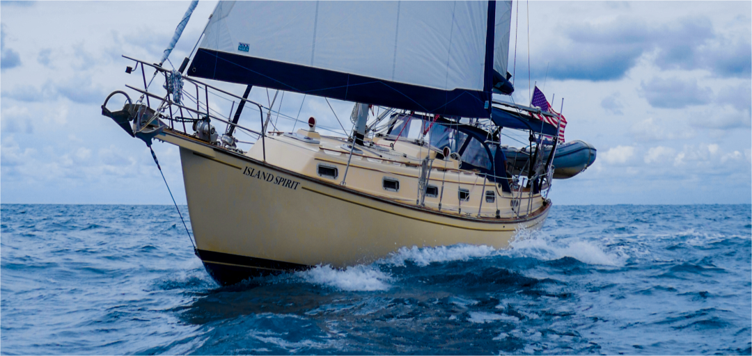
We have said for many many years, that the hardest part is leaving the docks and actually getting underway! Deciding to actually depart safe harbor. Deciding to set sail. Deciding to leave our beautiful Biscayne Bay that we love so much. Deciding to sail over the horizon. Off we will sail, Wed morning at 6:30 am. The yacht is fueled up, ten gallons of extra fuel is tied up on deck, the tender is taken apart with the 15 HP Yamaha removed and placed onto the rail. The 6 gallon fuel tank was removed and stowed on the rail. The 110 lb tender has been ratcheted into place and cross tied to prevent swinging.

Extra diesel fuel on deck

The life raft has been pulled out and tied to the helm (Thank you, GREG!!!). The ditch bag has been placed at the mast base and the EPRIB radio has been checked. The SSB communications are working well and we are checking into the Cruiseheimers network at 0830 and at 1700 on frequency 8.152 mhz. The Verizon Cell phones will be suspended in the AM and the SIMM card for the Bahamas will light up when we see a Bahamas cell tower. The WiFi Bullet 2hp rig has been checked and accessedWiFi services, so that will give us a distributed network onboard when connected. Full provisions, food, drinks, paper products, and wine have been bought and hand trucked back to the boat and stored. All spare parts have been checked, the engine oil and transmission oil have been changed as well as all filters. In the last two days, the head pump was rebuilt, the exhaust system was re-worked due to a leaking anti-siphon valve, and the aloft rigging of the radar reflector was installed.

Yes, leaving the dock (or safe anchorage) is the hardest part, as it seems like you are NEVER ready to go. So, you simply set a date and then you go. Once underway, if nothing breaks, it is usually a BIG relief to get to sea and to get away from the continual shopping, repairing, and stowing. By the time you read this, we should be in the Gulf Stream, i.e. The Florida Current, and well on our way. Thanks for sailing along. Bahamas run #3 begins NOW….

Beautiful Key Biscayne
Radeen making a great dinner
Birthday Radeen, heading out to her birthday dinner
The new replacement vented loop on the exhaust system
What a great birthday present. This could top the anchor Christmas present I gave Radeen 🙂
The tender gas tank full and stowed on the rail (notice the new helm seat!)
Our last sunset on Biscayne Bay, until next winter.
Biscayne Bay could become our new favorite place.

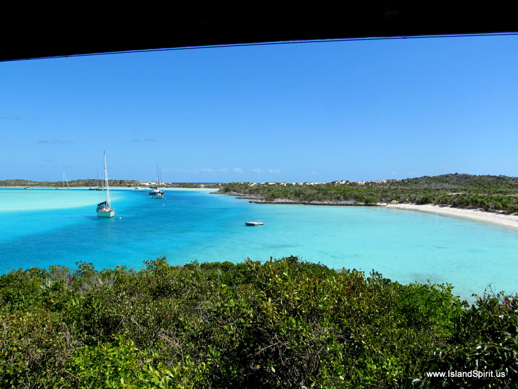
Bahamas run #3 begins now and we are ready! We planned March in the Exumas and April in the Abacos. Since we are running a little late into the Exumas, we may spend most of our time there in the Exumas Land and Sea Park area. BLUE WATER here we go…..
————————————
More UPDATE 5am:

Our Weather has changed significantly since last night.It is begin effected by this large gale up north. Look at this view of the entire Atlantic and how it is pulling the winds into these lows. Look at the storms and then look at the inflow of the winds from all the way down here in Miami…

Full Gale mid Atlantic pulling the winds SE

Second Gale off NC coast pulls the winds south in the Bahamas

Here are the NOAA South Weather Zones
http://www.nws.noaa.gov/om/marine/zone/south/stheastmz.htm
Please follow and like us:

The Exumas Planning

Please follow and like us:
the challenge of crossing….

We are looking for a sailing exit window to make the run from Miami to the Exumas. This run is only about 200 miles but it is nearly due east. The trade winds normally are blowing from the east and that makes it impossible to sail east. The winds will shift to the south when a storm up north in PA, VA, NJ, etc develops and then drags a cold front across Florida and out to sea. When this happens, an approaching cold front, these SOUTH winds develop and that lays down the northward flowing gulf stream and makes for even a better crossing. With south winds we can sail all the way east up onto the Bahama Banks and then keep sailing all night long into the tongue of the ocean and onto one of the three customs and immigration check in points. These are: Chub Cay, Andros Island, or Nassau. We like Andros or Chub.

Here is a south wind, but this has now changed

Waves in the gulf stream can be 5-10 feet when the north wind is blowing against the north flowing waters. The other situation is that an approaching cold front also means approaching strong North West and North and North East winds as the front moves through the area. That too is a bad situation because many of the hiding places are not good in North winds, most are protected from East winds. This weather timing game is a real challenge. You can have a calm peaceful passage if played right or you can beat yourself up and break your boat by getting the decision wrong or by having the winds and cold fronts advance faster than expected.
We have our boat loaded, fully stocked up as planned for a March 1 exit. All systems have been checked, and we are waiting. Waiting for a good weather window. Waiting means enjoying the Biscayne Bay beaches, anchorages, South Beach, Key Biscayne, etc. We visit with boat buddies, share plans and routes, have cocktail parties, and walk the Coconut Grove town. It is not a rough job to wait for a good weather window especially when here in the Dinner Key area. There is plenty to do and plenty to entertain yourself with, so we have no problem waiting. Remember, our goals this year are two: #1, Biscayne Bay area for at least a month; #2. Block Island for the summer, everything else is a bonus. So let’s wait for a good weather window….

Here are images we are studying and tools we are using.

www.PassageWeather.com
http://passageweather.com/index.htm?http%3A//passageweather.com/maps/florida/mappage.htm

NOAA Chart Viewer Online
http://www.charts.noaa.gov/OnLineViewer/11013.shtml

Our own summary of the courses and the legs, distance and times

This is a calm before the storm winds
one feather is 10 knots, 1/2 feather is 5 knots
Here you see 5 knots for our crossing
Then you see 25 knots up north coming our way
Can you beat this?????

This is the NORMAL east trade winds. You cannot go east in this
If you are in the Exumas, you can sail north and south

Sail along with us, use these tools and study the weather. When would you make this run? What looks good to you. See the winds and the waves here:

http://passageweather.com/index.htm?http%3A//passageweather.com/maps/florida/mappage.htm

Please follow and like us: