Crossing the Mona Passage

The Mona Passage is the area between the Dominican Republic and Puerto Rico. This is a very well know passage with a reputation for being very difficult and rough. This was our second time crossing the Mona and once again the seas were kind and the current not too strong. The route from Samana Dominican Republic to Puerto Real, the harbor where we arrived, takes you right along the DR coast line until you reach the point of Cabo Engano and at that point, you turn more southwest to cut inside and across the “Hourglass Shoal” at the narrowest part. The reason you do this is that the current is flowing north and the 1,000-foot deep waters are pushed upward to 80 feet which can cause serious sea state at the Hourglass shoal. So, you cut across this at the narrowest point and avoid that sea state. Here is a chart of the route.

Crossing the Mona Passage

Get Off Soundings

Another situation that you need to address is the fact that the Dominican Republic fishermen run miles and miles offshore in their little boats setting out their fishing gear. This can be polypropylene line and milk jugs and plastic barrels, etc. This gear is floating on the surface and usually anchored as well. So the solution to avoiding these fish traps and fishing gear is to run out to the deep water and get yourself off soundings. That is where your depth gauge no longer can see the bottom. This is where the fishermen will NOT BE and you will also not run into their gear. This is especially important at night because you will never see the gear on the water.  So we ran out to deep waters and had no problems.

Fish Trap area and your course will take you over this area, head left, out to deep water
The Hourglass Shoal off the Dominican Republic, run south to cross the narrow area

Last Night in Samana, Dominican Republic

On our last in the DR, before we crossed the Mona Passage, Radeen and I had a “Date Night” and enjoyed a nice meal out at the marina. What a good time to reflect on our run from Annapolis MD to here. We count our blessings daily and we are so grateful for the freedom and skills we have to be able to run our boat on these long passages. We now look at 150 nm as a day trip and  300nm leg as just a little bit more than “a Block Island run” as we call it. We reference that 240 nm trip because di it 10  summers in a row and loved it. Now, here we are, running for the Caribbean Sea. Thank you Radeen, you are a great sailor GrL. 🙂


Date Night with Radeen

Course 130 degrees, winds 090 degrees, usually

It seems like the entire run from the Bahamas to the Caribbean Sea is a course of 130 and the winds are usually 090. If you are lucky they move north to 080 or south to 100 which still places the wind 30-40 degrees off the bow. Unless you have a J boat, you can not sail this course. You will be motor sailing with a reefed mainsail or a staysail or a partial jib. Then you sheet in hard and run your motor and power into the wind. What you are looking for is a calm wind, something in the range of 10 knots to 13 knots, because at 15 knots to 18 knots the seas come up too much. Now you are bashing into the sea state and beating 30 degrees off the bow. That is an ugly ride and with hundreds of miles to run, you do not want to do that.

Daybreak is wonderful at sea.

We run Autopilot on Windvane steering

The way we run these long legs is on autopilot, of course. We do is set up our sail plan and that is usually a staysail or a double reefed main. Then we point the boat 25-30 degrees off the wind, sheeting in the sails hard. Now, set the autopilot to hold a given wind angle of 30 degrees. The pilot will keep the boat at this angle to the wind. As the winds move left, the boat heads left, as the winds move right, the boat heads right. Overall the course is good and the boat and the sails are happy. Nothing to do but stand watch and check your engine room and bilges and monitor the course.

The view over the helm from the port seat.

The Blue Ocean

We are always amazed at how blue the ocean really is. All these photos are cell phone photos and the ocean really is this blue. It changes as the sun is high or low and at night, of course, it is black. But when the sun is midday, 11-4pm the ocean lights up in this beautiful blue. Look at these photos…

Departing the Dominican Republic, Cape Samana
Full sail 40nm out of Puerto Rico, crossing the Mona Passage

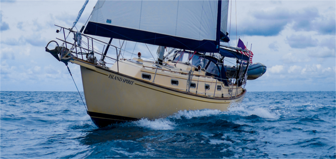
Arrival in Puerto Real, Puerto Rico

The run from Samana DR to Puerto Real is 145 nm or 24 hours plus an hour or two at 5.5 knots. We departed at 1400 and we arrived in Real at 1400-1500. The Mona was very kind to us as the winds moved to 090 and eventually 080-050 and went very light. It was a port tack set the entire way. We ran a staysail and a full 110% jib most of the way plus the 2600 rpms on the Yanmar. We motor sail like this at 5.5 to 6 knots and we burn 0.75 gallons per hour. Once in Puerto Real, we went to the fuel dock, filled up 19 gallons and then moved dropped an anchor. We stayed anchored out for two days. Puerto Real is a great place to check in, as CBP is at this marina or you can use the CPB ROAM app which worked great for us. Welcome to Puerto Rico, a dream place to cruise along the south coast.

sv Island Spirit anchored out off Puerto Real
You can always find us with this 9 foot Gold Island Packet Battle Flag. We also fly the Whiteaker Yacht Sales flag as we are brokers for WYS team.

Live Tracking Map

Remember, we have a Garmin Inreach satellite communicator and this devices places a map pin down anytime the yacht is moving (provided we remember to turn it on and start tracking 🙂 The great aspect to this, is that it shows time, date and speed, so we can look back and study how long it took us to go from A to B. It is also a wonderful archive map of our travels. This map is showing the current trip ONLY from Annapolis, MD to our current position. We have other maps from our many years of cruising under our MAP menu link. Thank you all for following along with us. Here is our map:

https://share.garmin.com/IslandSpirit

Samana, Dominican Republic

We motor sailed out of South Side Marina, Turks and Caicos, southward to deep water running the 14 nm off the banks to French Key. There we turned SE to run outside the Caicos Banks to move the 75 nm around to Big Sand Key. This would be our staging point to make the 184 nm run to Samana, Dominican Republic. The challenge is getting across the 50 nm of Caicos Banks and not hitting a massive coral head.

Our Plan to run south, then SE to Big Sand.

A Bashing below the Banks

Well, the run south of the Caicos banks turned out to be one of the roughest passages we have had in many many years. Waves came up to 3-4 feet at 4-5 seconds, and the winds came up to 15-19 knots directly on the bow. We buried the bow light at least 50+ times. Now, that is really pretty at night when your bow light, that is 8 feet off the water, dives down into the coming wave, punches thru the wave and then illuminates the wave with red to port and green to starboard. WOW, that is beautiful, maybe once or twice, but when it happens from 7 pm to 5 am it is a real beating. It was not possible to sleep at all. We arrived at Big Sand Key at 6 am. What was to be a 14 hr passage turned into a 21-hour beating. Not fun. We dropped anchor, washed the boat, and crashed!

The view out the windshield at daybreak after taking salt spray over the roof all night long!

Big Sand to Samana, Dominican Republic

Now we were staged at Big Sand Key placing us 184 nm from Samana, DR. The forecast was holding, and that is good because there is no place to go from here except north to Grand Turk. The winds were to be calm, 10-15 from the SSE, of course, that is directly on the bow with a course of 130. So, we motor sailed again, a staysail and the engine on 2700 rpms making 5.5 to 6 knots. We ended up taking several tacks as we kept moving EAST. We knew the winds would shift and like clockwork, the EAST winds came in right on schedule and then we could tack back to port and run our 130-degree course directly to Cabo Cabron and then Cape Samana.

A very welcome sight, Cape Cabron at day break
Rounding the second cape, this is Cape Samana, DR

Docked at Bahia Puerto Marina, Samana

We sailed into here in 2017 on our first trip south with our fun “Team Six Knots” and we knew how lovely this place is. So, it was a joy to return to this five-star marina resort with infinity pools and cafes and pubs. This place is really amazing and at $1.00/foot, it is a real deal. Look at this clubhouse and condos!

The clubhouse with a gym, billiard room, pubs, and more

The pool is a big bonus here for Radeen, as she loves to swim. It is an infinity pool where the water is level with the edge and it flows over the wall to a lower reservoir overlooking the Bay of Samana. This makes for great photos looking out to sea and at sunset.

Radeen in the pool
Sunsets here are amazing

Rental Car adventures and Touring Samana

We rented a car with our buddies John and Darcy of 45 Ft Jeanneau KINDRED SPIRIT and hit the road. Within the first ten minutes, I nearly wrecked as cars were cutting me off and motorcycles passing on both sides. Welcome to Samana, DR. Drive like you stole it, and hope and pray you don’t wreck.

Typical downtown Samana and all the motorcycles.

Off to the Country Side

After a quick tour around Samana and a good 30-45 minutes to get a sim card for the cell phone ($2 sim and $5 for 5 GB) we now had coms to hit the countryside. We headed to a waterfall and hiked up into the hills only to not see any water as the riverbed was dry so we turned around and headed for the beach at Playa de Valle. This is where the real adventure began.

Typical bananas everywhere
Beautiful overlooks
Local transportation

Did anyone put gas in the car??

Well, we tried, and at our first fuel stop due to none of us speaking Spanish and the attendant not speaking English, we eventually were able to put in 300 pesos.  Great, we are good to go….WHAT? 300 pesos only gave us 1 gallon at best. Well, the next thing you know, we are in the middle of nowhere and nearly out of petrol. So, we stop in this village, horseman hauling bamboo, and locals having lunch, someone found us a gallon of gas! Really? Yes, the locals are so kind and so helpful. For $300 pesos, and of course, I bought some Brugal Rum off the little street vendor to help, and we tipped the local for helping us. By the end of this activity, we were drinking our Brugal with the locals and having a great time. WOW, how fun.

Local transportation and local casino!
Hoseman hauling bamboo home passes by
A local finds us a gallon of gas, pours it in

Gassed up, we can make the beach

With the car now fueled up, we can now push onward to the beach. By the way, this is all within a few miles from Samana. the rental car comes empty, you put gas in. Oh, thank you. We then found the Playa de Valle beach town with a beautiful scene, fishing boats and of course a great little pub. How about some Presidente on the beach?

Fishing boats on the beach

Local Services, Schools and Health Care

On the drive home, we noticed the health care building and we also noticed the local school. These government buildings are well cared for and provide services to the locals. Here are two buildings, a health care building and a school.

The local healthcare building
The local school

Back at the Marina….ahhhh

You can see why this marina is so amazing as it is beyond anything you will see anywhere else in the area. Yes, there are many 5-star resorts in the Dominican Republic, but only a few marinas like this. We enjoyed our time here and we really admire the Dominican people as they are so kind and so polite and so helpful. They really want us all to visit this amazing island.  I hope you can visit some day.

Down with the Q Flag and up with the Dominican Republic Flag
Hayden and Radeen at the Puerto Bahia Ocean Club pool. paradise.

Onward to Puerto Rico….

Live map and tracking here:

https://share.garmin.com/IslandSpirit