Puerto Rico Isla Caja de Muertos

Puerto Rico continues to surprise us with interesting locations. After Puerto Real, Boqueron and Gilligan’s Island, we stopped at Isla Caja de Muertos, a state park on an island off the south coast 6 miles south of Ponce. We wanted to climb up to the lighthouse and also enjoy the beach and a swim in crystal clear waters. We are here with mv/SEA STAR, while our friends on s/vFEZYWIG pressed on to Salinas, where we will catch up with them. It is the beginning of Spring Break and also a weekend so the place was really alive. The Puerto Rican music was blasting as the local families rafted up their boats, drank, swam and simply had a great time together. We anchored off the ferry dock where tourists and locals are brought over from the main island and dropped off for the day. Then at 1530, the ferry blows its horn and everyone departs the beach, leaving it empty for us to enjoy!
This panoramic photo shows the two islands with a very low lying area in the middle where the beach is located. The lighthouse is on the hill to the left and the fisherman’s chapel in a cave is on the hill to the right. After we anchored and launched the dinghies, we headed off to find beach access to walk the trails leading up to the lighthouse. After several beach landings and nearly swamping the dinghies, we finally anchored the dinghies off the beach about 50 yards out and swam ashore. Then we hiked up to the lighthouse. Here are photos of the cactus laden rocky trails up to the lighthouse….

Once we reached the summit, we found wooden observation decks which in very questionable condition, but we had to get a great selfie on the overlooking platform. Our boats are anchored in the distance to the right. What a beautiful view, well worth the climb.
After lunch back on our boats, we took the dinghies into the state park beach where the locals were enjoying their last hour on the beach. At 1530, the ferry boat blew the horn and the beach emptied. We then had the entire place to ourselves. We swam, beach combed and walked the park, 
and then we headed back to our very, very rocking and rolling anchorage.
Of course I had to take some swimsuit photos of Radeen, my favorite photo subject. What a great setting with the rock wall and the beach. How fun….

As the sun was setting, we all decided to head for “home” and make dinner and call it another great day of cruising and discovery. Of course this required another “Hayden Selfie”….Fun Fun Fun with Bill and Lauren of mv/SEA STAR, a Grand Banks 42.

We then returned to our rolling boats and we tried to make dinner and relax, but the roll and the ocean swell made it a very, very long night. At 0601, we pulled up anchor and headed out to sea saying good bye to Isl Caja de Muertos. Onward to Salinas…..

Caribbean Sea Goal Reached

…a lifetime goal reached…

We crossed into the Caribbean Sea on Friday March 31, 2017. A lifetime goal reached and accomplished, that being buying a sailboat, learning how to run it and then taking it to the Caribbean Sea. It has been 1,410 nautical miles since we left Stuart Florida after out refit work. From Stuart, we moved down to Biscayne Bay where we broke in the Spectra Watermaker and enjoyed great friends, Freddie and Gail onboard. Then on Super Bowl Sunday Feb 5, we sailed out of Miami bound for the Caribbean Sea and now, we finally reached that line where the North Atlantic ocean touches the Caribbean Sea. This point is Cabo Rojo on the southwest corner of Puerto Rico.

Small but mighty, Island Spirit pushes on to the Mona Passage

We crossed over the Mona Passage direct from Samana, Dominican Republic, with an overnight rin of 150nm in about 20 hours. We arrived at Puerto Real, which is on the west cost of Puerto Rico, there we checked into customs via a phone call and enjoyed the quet little fishing village. From there we moved only a few miles around the bays to Boqueron, another fun small local village where we worked over the local beers and had another fun night.

Then finally we left there and powered on around the SW corner and reached the Caribbean. Radeen and I were so happy and proud that we actually made it and NOW we will base our boat in this beautiful  sea for the next 4 – 5 years.

Cabo Rojo Lighthouse where the Atlantic meets the Caribbean Sea

For now, we need to power east into the trade winds and work our way down the south coast of Puerto Rico. The normal process is to up anchor at 0600, daybreak, and motor sail into the lighter trade winds until about 0900-1000 at which time the winds build to 15-20 knots and the seas come up. So, we turn into land, find a place to anchor, maybe a cool town, and drop the anchor around 1000. This process is detailed and explained in the book by Bruce Van Sant, “Passages South, the Gentleman’s Guide to the Thornless Path.”

Powering into the East trade winds early in the morning using the engine and staysail

Then, we have the day to discover this new spot, dinghy into town and explore….

Taking a break and exploring the local towns and drinking the local beer.
Hayden’s hat is sporting the logo of the local beer, Medalla.

Then we get up and do it again. If we want, we could head out in the evening at 1700-2100 when the winds drop and then motor sail all night into the light east trade winds until the AM. We plan to do that to reach the Spanish Virgin Islands of Veiques and Culebra. After cruising these, we will then push into the US Virgin Islands of St. Thomas and St. Johns, and then finally the British Virign Islands. For now, we are enjoying our short hops to the interesting small towns and state parks along the coast.

We really like Puerto Rico….it is very interesting

Overall, we are very impressed with Puerto Rico. We thought we would just blast on by here, but now we are finding all these very interesting villages and harbors with mangrove islands. Very fun!

Just look at Radeen’s very happy smile as we rounded Cabo Roja and reached the Caribbean Sea. Radeen loves to travel more than anyone I have ever known. We both love to sail and live on our boat, so, it was only natural that we now travel using our sailboat. We will rediscover the islands of the Eastern Caribbean, many of which we have chartered to before, but this time we will have no schedule and no timeframe and that should make this really very special.

Beautiful Radeen, happy Radeen, traveling Radeen

Welcome to the Caribbean, it is going to be a very exciting time ahead for us. This map shows each day of our passage along the coast. Thank you for sailing along…..

DR to PR Puerto Rico

…Goodbye DR, hello PR…

With a serious low pressure storm north of us, the normal east trade winds have been pulled to south flowing into this storm giving us a nice motor sail 150 nm from Dominican Republic to Puerto Rico where we planned to enter the USA at Puerto Real. This crossing of the Mona Passage is well known in the cruising circles to be difficult and always rough, with confused seas and unpredictable currents. Lucky for us, this passage turned out to be relatively calm with a 5 foot swell of 9 seconds with a wind blown chop of 2-3 feet.

motor sailing out of the DR for PR

The beginning of the trip was flat calm with main and jib and 2500 rpms motor sailing at 7 knots out of Samana harbor and past the capes. By midnight, we reached our point in the 1,000 to 2,000 meter waters well off the “hourglass shoals” which is known to have confused seas and crazy currents. We found the seas were a bit confused and the current was not too strong. We had a NE swell, and NW wind blown chop, and a S current, all making for a strange sea state. But overall, it was a relatively calm passage. We then turned SE for the Puerto Rican coast, aiming for the SW corner where we could check into Puerto Real harbor.

Docked in Puerto Rico

We had made reservations for all three boats at Marina Pescarderia in Puerto Real, where the the fee is $1.20/foot. This marina is in a fishing village and the people are extremely friendly and helpful, though most do not speak English. From here, we plan to make small, easy, short, early morning hops along the south shore of the Puerto Rican coast, discovering all the great towns and harbors this island has to offer. It is GREAT to back in the USA after sailing out of Florida on Super Bowl Sunday, Feb 5.

Here are some photos of this passage and arrival.

Our last days in Samana, Marina Bahia were filled with pool swims, movies and playing Mexican train. What a fantastic place to hang out, and all for $1/foot!

Our lobby where we enjoyed relaxing

Island Spirit in the shade, Radeen heading for a walk
When in the DR, drink the local and smoke the local

Departing Samana,, we motor sailed out the bay into the open North Atlantic where we found a nice 5 foot ocean swell of 9 seconds

Heading to sea with Cape Samana in the distance

The DR coast line falling away on starboard

Along the DR coastline there were many floating fish nets and traps!
As the sun came up, after our overnite run, we were looking at the west coast of Puerto Rico, what a beautiful sunrise to great us as we motor sailed into the USA.
Sunrise over Puerto Rico, welcome to USA

Our B&G Zeus as we motor sailed in to Puerto Real

First item, call into USA Customs and check into the country 
Next, raise the Puerto Rico courtesy lag on the starboard spreader

We walked around town and of course had to find the local bakery where we bought FLAN for Radeen and ice cream for Hayden. 
A short walk up to town we found the bakery
Flan for Radeen, WOW was that good!

The local waterfront houses and fishing boats
Our local store with fresh MILK and EGGS! yahoo

When in PR, you drink the local beer
Not bad for a light beer

Our local dock neighbor lights up his boat with this very coolio blue LEDs, and lots of underwater lights, add in the loud very fun Puerto Rican music and we have a P A R T Y…fun fun fun
P A R T Y on

Here are the Charts showing the run from DR to PR directly without going into Luperon or Ocean World or any of the normal stops along the way. We were lucky to have the correct weather for this run and would do it again.
This is the Overview of the course from DR to PR
You have to go out 25 NM off the DR to clear the Hourglass Shoal where waves and currents are bad
The turn around the reefs and then into the coast of PR where we made Puerto Real
Hear are some great photos as we leave the DR and head for Cabo Engano

Crazy Fish traps all along our course
Our buddy boat FEZYWIG a Lagoon 38

Lagoon 38 FEZYWIG in the ocean waves

Island Spirit in the Mona Passage heading to Puerto Rico
Photo Credit: Meloney on sv/FEZYWIG

 Here is our first sunset from Puerto Real harbour where pelican are plentiful and the harbor is calm and protected. We think we will really enjoy exploring all the harbors and towns on the south side of Puerto Rico.

Mona Passage plan

…Another Large Storm helps us…

We are checked out of the Dominican Republic and we have our exit paper work called a “Despacho” which will allow us to legally leave the country. This all took about 4 hours with customs, marina office and the navy officer to check out our boat. Once all was signed, stamped and approved, we were given the proper paperwork. Next task was predict wind app which we now spend an hour a day on as we study the winds and the swells. As it looks tonight at 1900 Sunday, with a planned departure at 0700 Monday, it all looks good to cross the Mona Passage. This is a 150 nm run all into the east and with the current storm up north of us, once again we have the winds pulled from east to southeast and then flipping to northwest. The storm has the ocean really kicked up into a 10 foot to 15 foot swell but that is north up in the Bahamas. For us the swell is predicted to be 5 feet out of the north east which will put the swell on our port beam. The winds are to be on our stern at 10 knots. We plan to check into Puerto Rico at Marina Pescaderia in the town of Port Real Tuesday at 1200-1400. Here are the captures of the predict wind app.

HERE ARE THE WINDS

Samana 0700 when we depart port
Monday Midnight as we push onward

Tuesday 0800 as we approach the coast of Puerto Rico
Tuesday 1400 we should be docked at the marina, ready to check into the country

HERE ARE THE OCEAN SWELLS
You can see the large storm up north of us. This is causing the swells

5 foot swells on our port beam. Not a bad ride, we hope

This shows the ocean swells for the entire 24 hour trip

This being our first crossing of the Mona Passage, of course we are looking at all data we can access. While here at the DR marina, we have had intermittent internet access making it difficult to get our weather information, let alone blog.  We do feel that we have a good weather window to cross the Mona Passage, once again, a strong storm far away from us has pulled the trade winds south and then north and has given us a passage opportunity. Sometimes cruisers wait for weeks to cross this passage, we waited 4 days! OK. We will see you in Puerto Rico…..

Santo Domingo DR

…as least we had a car…

We rented a car for the six of us using Oliver at the marina excursion office and we received a mini van with a seriously cracked windshield and bald tires with a boom box and several amps. It also had a commercial taxi sign on the side door, so we could have offered rides as well. We are not sure where they got the car but no one asked questions. The rate was $90 US for the three couples to drive south to Santo Domingo to the colonial section of town. Meloney drove and did an unbelievable job weaving in and out of city traffic avoiding motorcylces, horses, broken down cars and trucks. We only were pulled over once for making a left turn like a pro at a 4 lane interesection where no lefts were allowed. She got out of the traffic ticket by showing Google Maps on the cell phone which had told her to make the turn. None of us could understand Spanish, he spoke no English, and so he shook his head and let us go with a stern look and a clear gesture to keep our eyes on the signs.

Fuel stop, look at the prices

Our first task leaving Samana was filling up the car which arrived on fumes. We stopped at the closet station 10 km away and we filled it up. That cost us $60 US and we ended up leaving about $20 of gas in the car at the end of the day. With wages averaging $10 per day here, this was a real win for the owner of this car. Notice the sign for the gas station prices. RD 210 per liter. The exchange rate is $1 to RD47. That works out to $4.46 per liter. One US gallon is 3.75 liters. So That means this is $4.46 x 3.75 equals $16.75 per US gallon! No wonder everyone is running around on small Honda Z3000 motorcycles. They must get 50-75 miles per gallon.

The next challenge was driving 3 hours from Samana to Santo Domingo and then finding our way around town. We crossed rice fields, rolling hills with cattle, river valleys, rugged mountain passes and finally into the metropolis of town. Once in Santo Domingo, it was C R A Z Y….like driving in NYC. Cars cutting us off, multiple lanes of traffic, signs in Spanish, treacherous culverts on the sides of the streets, children sprinting across the divided highways, few traffic lights and “Una Via” streets everywhere.
Thank goodness for Don’s LTE chip on T-Mobile, so he was able to navigate for race car driver Meloney as we quickly threw ourselves into the crazy flow.

Once in the city, we stopped at a super market to secure funds from a Western Union where buddy boat Sea Star needed some serious cash to fix their bent prop and prop shaft damaged while we all crossed the Caicos Banks. They hit a coral head in the low angle morning light where none of us could see the massive coral heads as we powered at 6 knots into the sunrise. The Caicos banks are dangerous due to these large coral heads. You can not see them until it is nearly too late. Unfortunately, Sea Star caught one prop on the edge of coral and took damages. Lucky for them, here in the Dominican Republic, they hired divers to replace the shaft and prop while in the water! WOW, amazing workers like this are needed, since we have heard there are no haulouts anywhere in the DR.

After a quick stop at the very large store, we moved on to the colonial section of town. Here are some photos of the Carrefoure Store. It was a food store and a Walmart type store.

Radeen and Meloney had a funny exchange with a young employee as they tried to find a small cooler. They pantomimed “cold” by shivering, then drew a box in the air and pretended to put something in it, while saying “leche.” He sent them to the aisle with jackets and sweaters! After wandering around, they found the coolers and brought one back so he could see it. They laughed together as he shook his head as if to say “Now I understand!” Part of the problem was probably the fact that milk here is all UHT milk in a box that does not need to be refrigerated until opened.
20 eggs shrink wrapped, unwashed and unrefrigerated. They will stay fresh for weeks.

Driving into the colonial section of Santo Domingo, we enjoyed seeing the street vendors’ carts of coconut water drinks and fruit stands. The DR people are so hard working and everyone has a shop, a cart, a stand, or some crafts to sell. It is really a bustling city and it was very exciting. Especially when compared to the Bahamas or Exumas.

Coconut water drink cart

Typical fruit stand

We parked the car and walked into the colonial district where we bought a very valuable English audio tour of the Cathedral Primada de America Catholic Church, the first cathedral in the new world. Construction began with the consecration of the land in 1514. Over the next 200+ years, they continued to add twelve small chapels onto the sides of the main sanctuary. The church is in amazing shape and was very impressive.

In the plaza outside the church is the monument of Christopher Columbus who sailed into Santo Domingo on December 5, 1492. This is believed to be his third landfall in the New World after first landing at San Salvador in the Bahamas and next Rum Island/Long Island and then here.

After our tours, we were guided to a lovely local restaurant named Mimosa by one of the government tourist guides who keep you safe from the locals who try to walk you out of the safe zone to shake you down. We all enjoyed a very fine lunch of various pasta meals and chicken dishes along with a dozen beers. The total bill for all 6 of us was 4,740 RD including tax and tip. This comes out to $108 US divided by 3 equaled $36 per couple! We are finding the local prices to be very reasonable and with the beer costing 100 RD or $2.12 apiece we can see why so many people vacation here.

Here are a few photos of walking around Santo Domingo

We bumped into this local arts celebration with a band and marching girls. They all looked so cute and happy and proud.

 After a full day in town, it was time to hit the road and drive the 3+ hours back to Samana where we arrived around 2030 hrs. What a fun day of touring the countryside of the Dominican Republic and the city of Santo Domingo. This country has so much to offer and it seems like the people are very hard working and proud of their country, as well as very friendly. The DR is a must stop place on the sailing cruising tour.

The drive from Samana to Santo Domingo 
3+ hour drive

Samana Dominican Republic

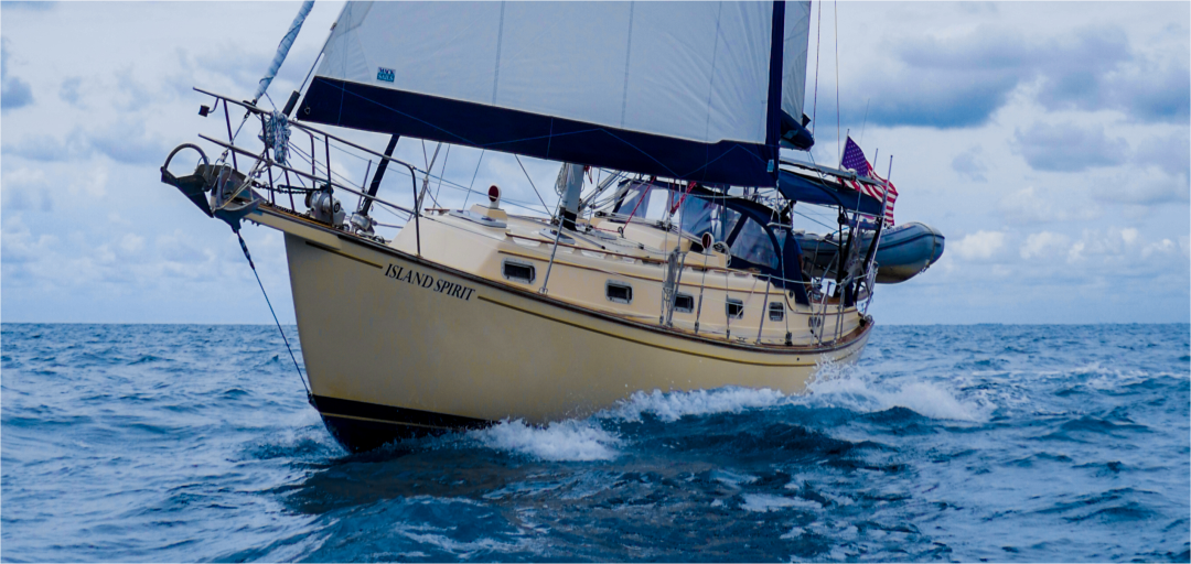
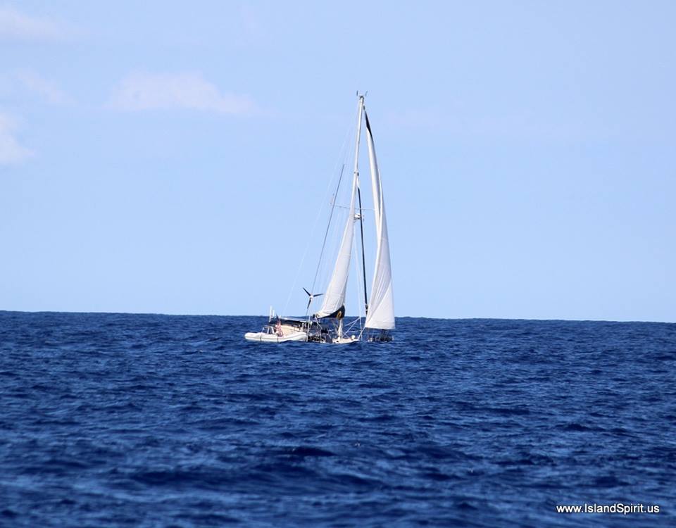
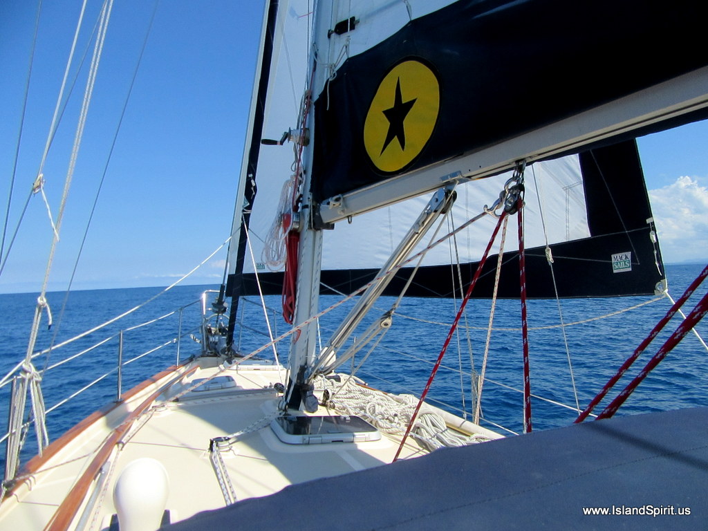
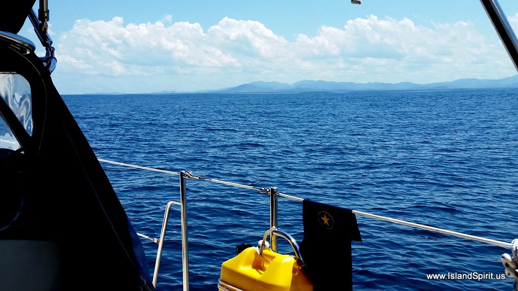
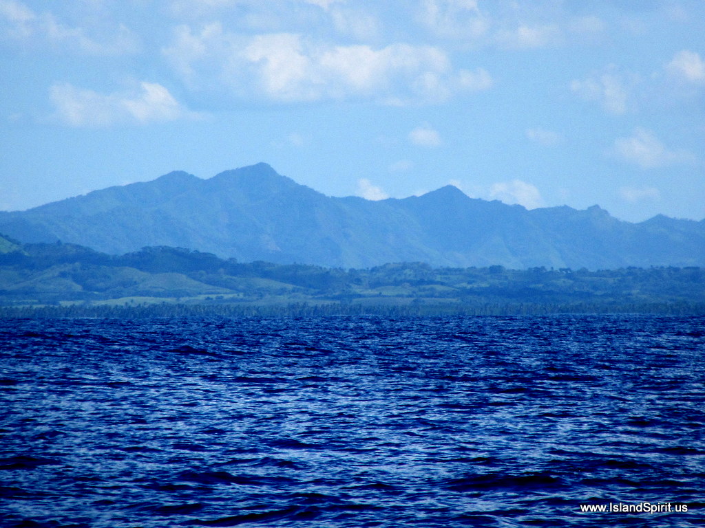
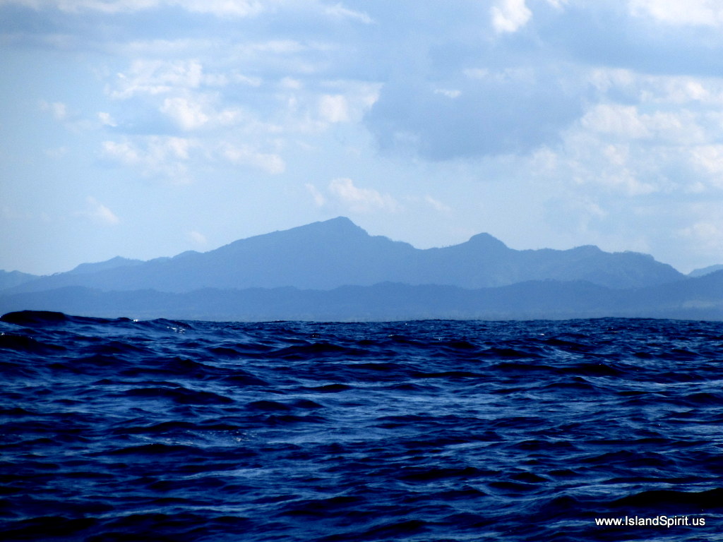
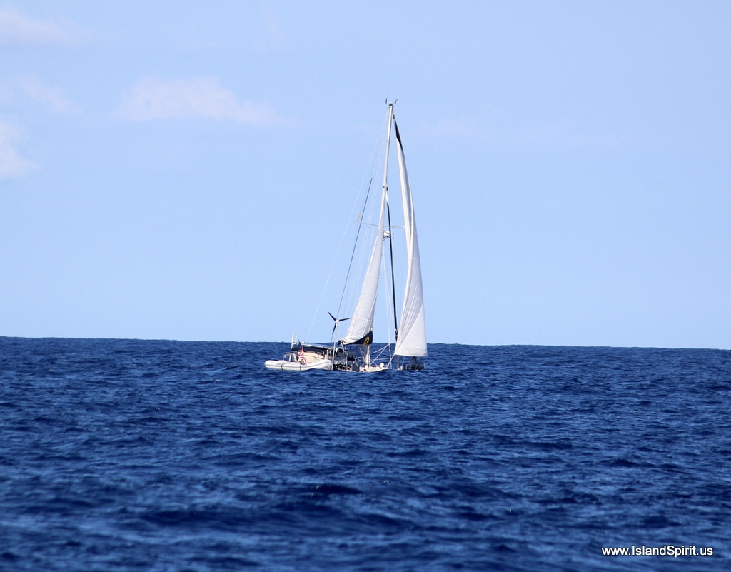
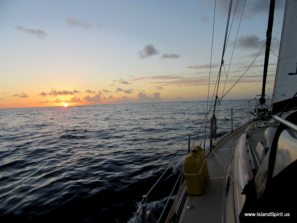
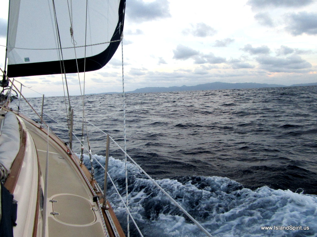
…The mountainous Dominican Coast under our jib…

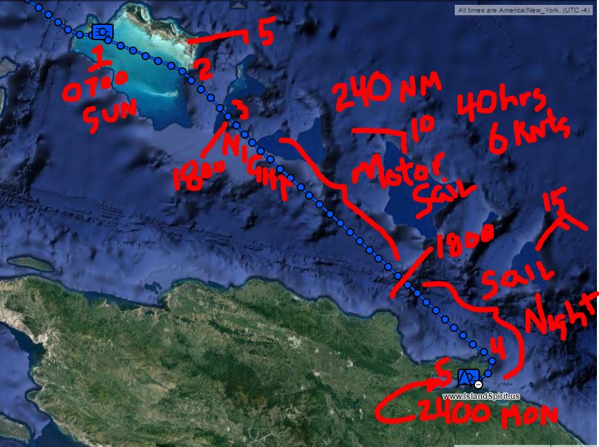
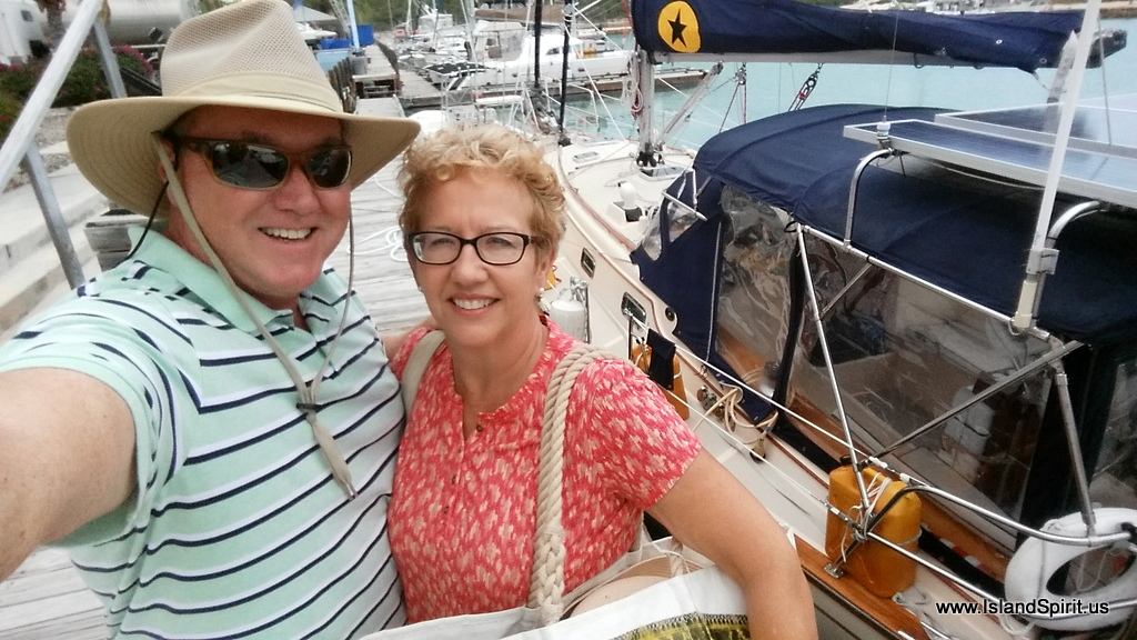
We made the 40 plus hour run (240 nm) from Provo, Turks and Caicos direct to the Dominican Republic where we docked at the beautiful Marina Puerto Bahia in Samana. This is a five star resort with multiple pools, cafes, comfortable lobbies and all for $1/foot which is only $35 a day. We plan to stay here 4-5 days until the next crossing opportunity for the 24 hour run across the Mona Passage to Puerto Rico. Being offshore for 2 nights and with only sleeping 2-3 hours at a time, we all were exhausted when we arrived Tuesday morning. After docking, we all crashed and then rallied for the pool happy hour where drinks are 2:1 at prices of $3 each.

The DR flag left, Puerto Rico flag right

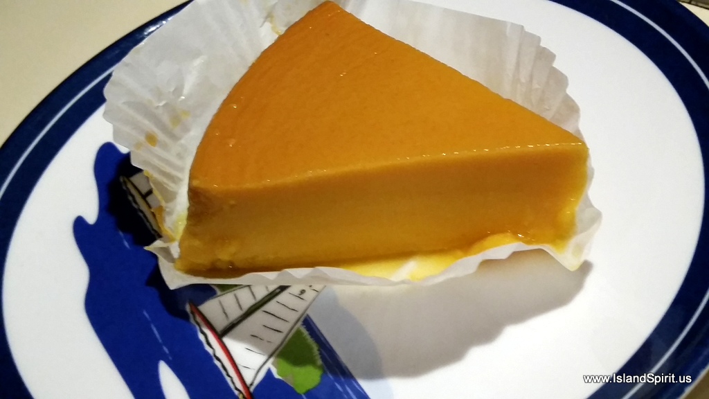
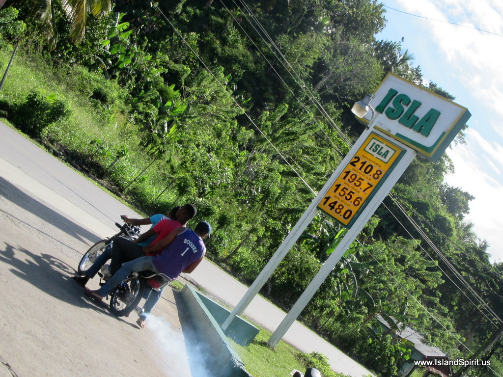
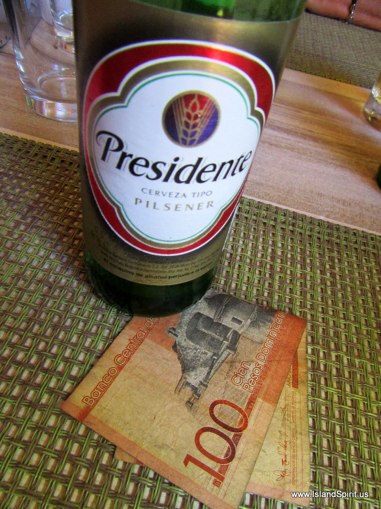
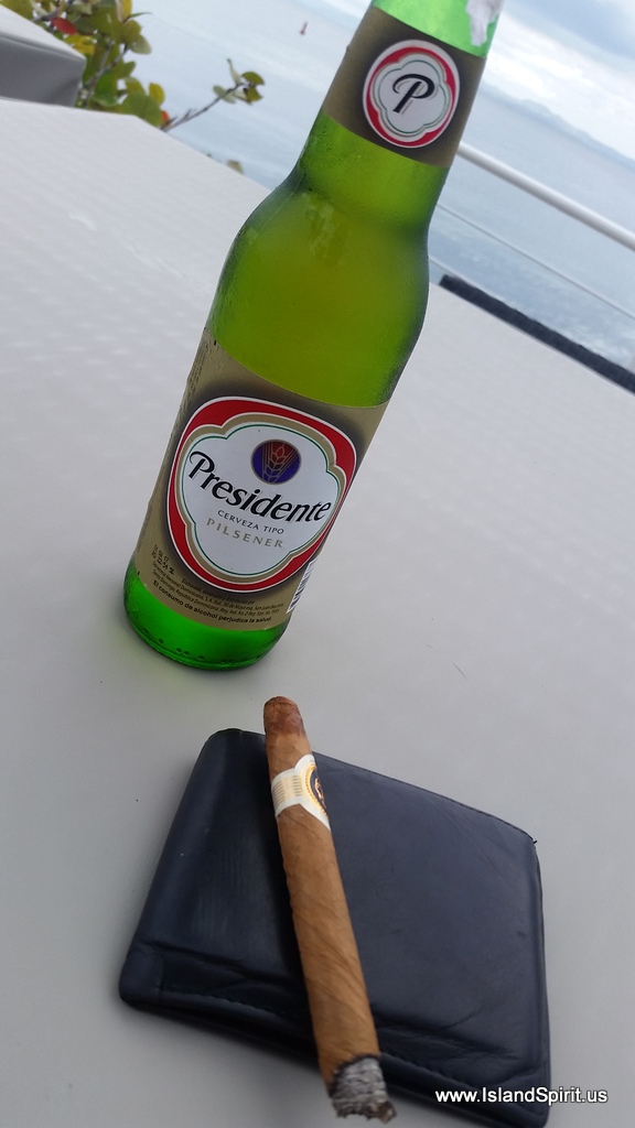
The DR peso is paying 47:1 USD. Yesterday I bought an ice cream bar for 80 cents! We already are concerned that it may be difficult to leave here. Then again, why leave? We have no schedule.

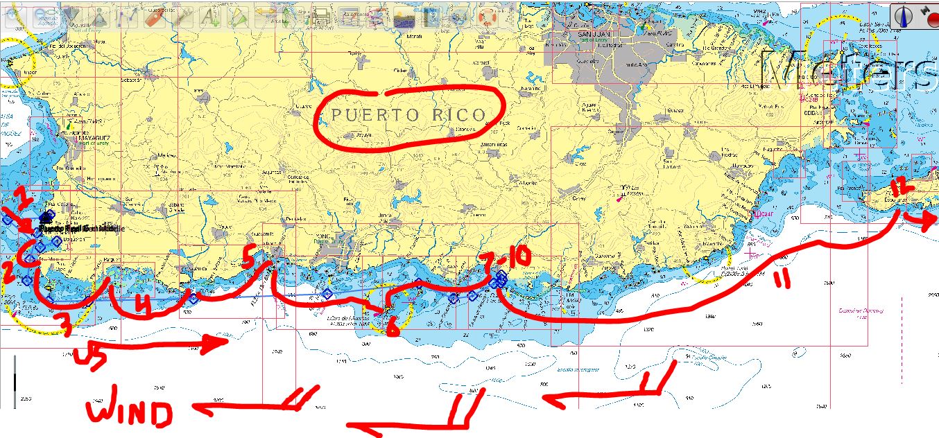
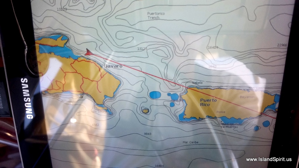
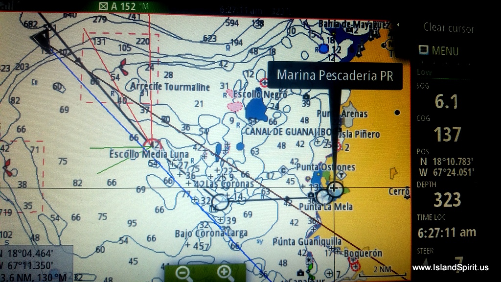
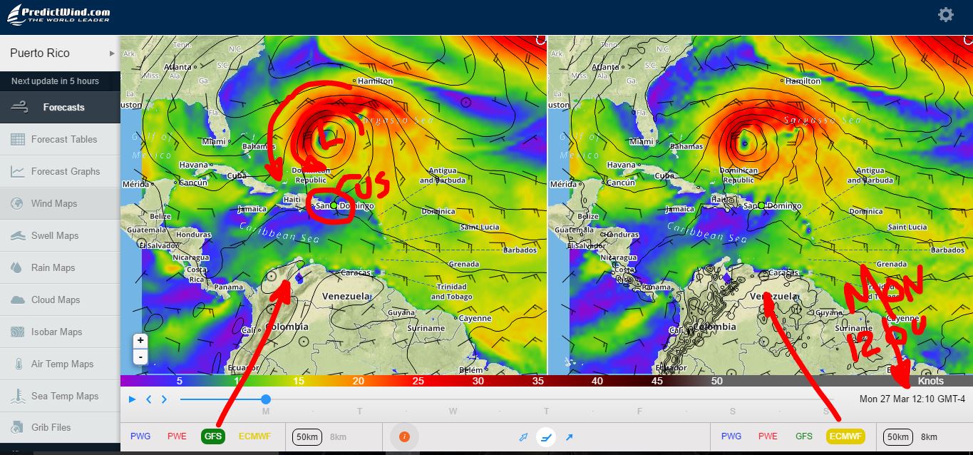
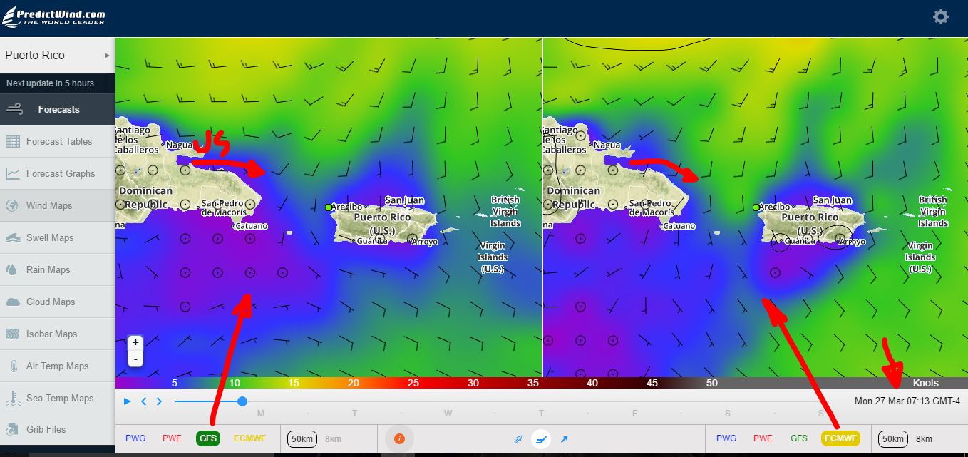
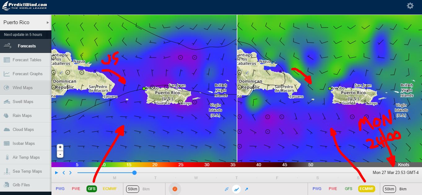
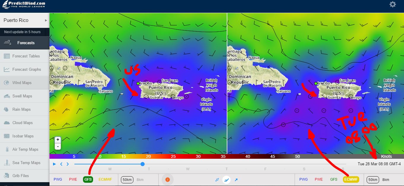
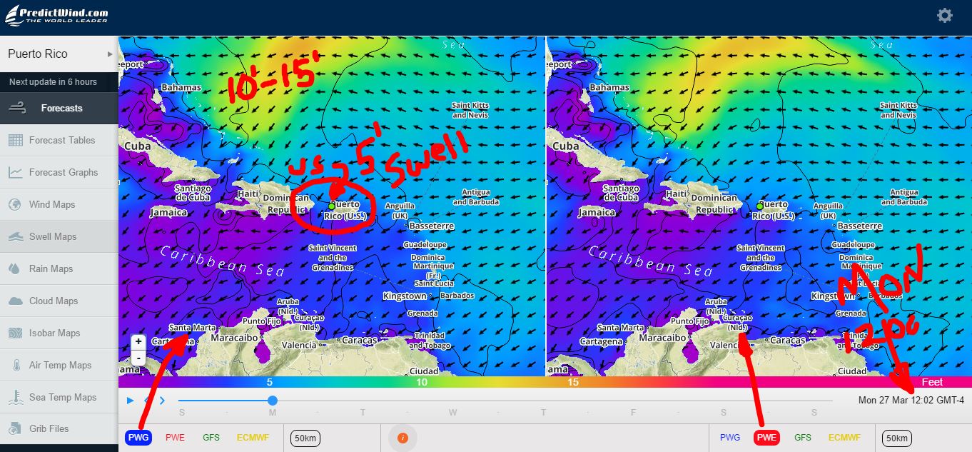
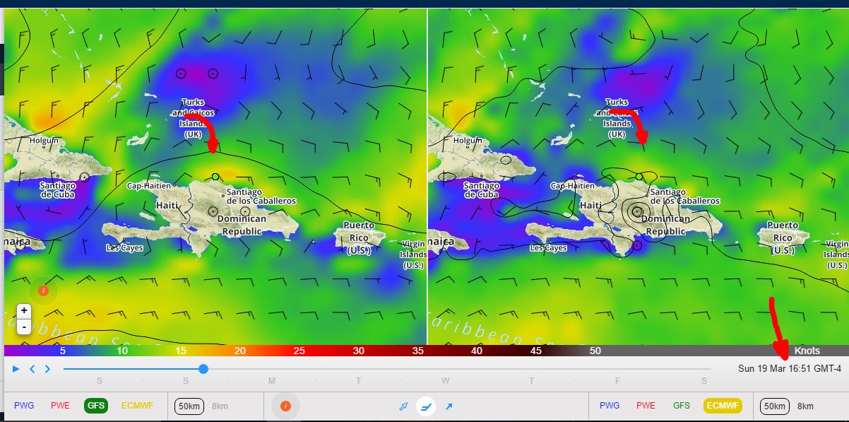
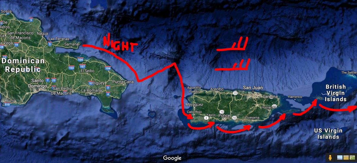
Our passage was in calm seas and light winds of 5-8 knots out of the east, exactly as shown on our Predict Wind app. Our course was 140 degrees placing the wind about 50-60 off the port bow. This was a motor sail with a full main and a staysail with the engine on at 2400-2500 rpms. The boat runs 6 to 6.5 knots round the clock in this situation.

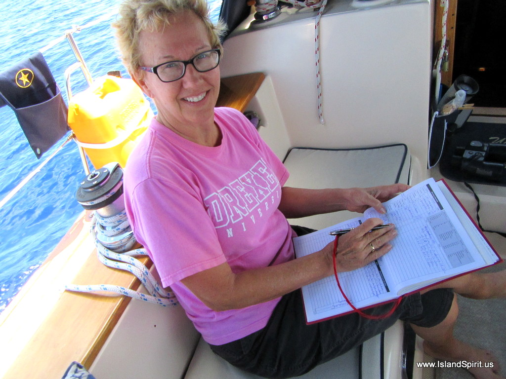
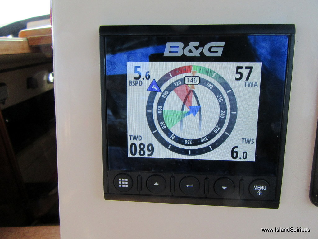
The wind shift as recorded on the Triton2
This is a 60 minute timeframe

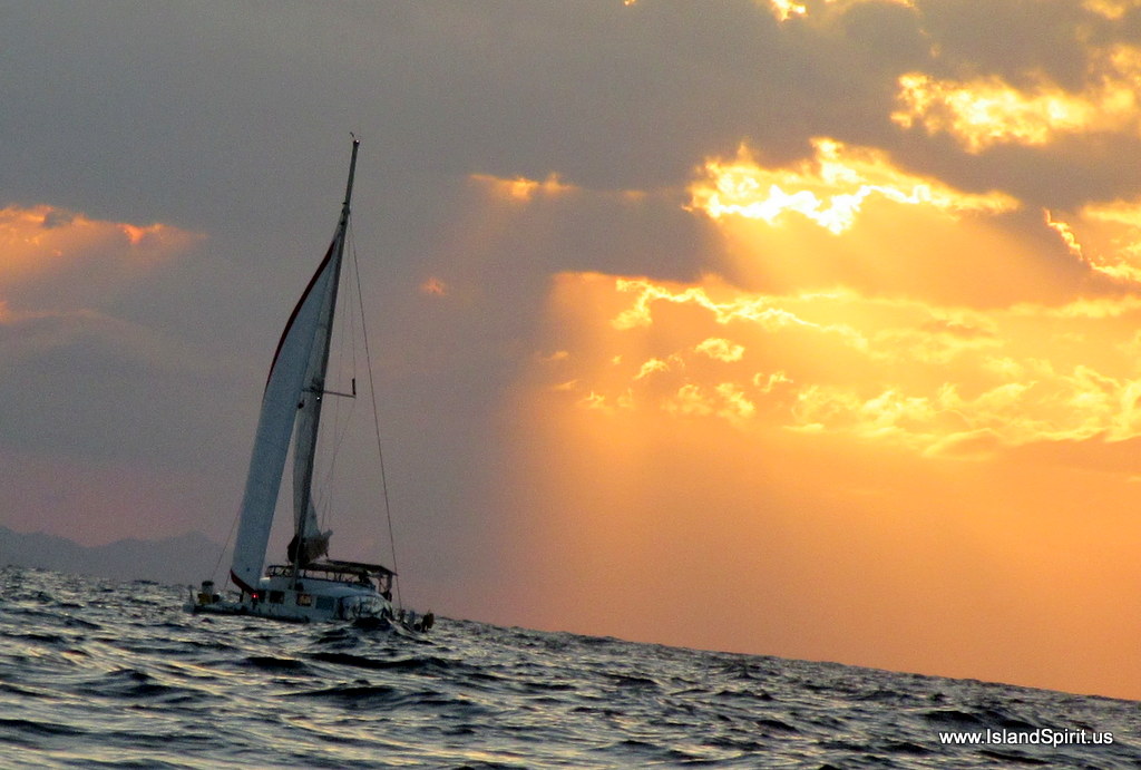
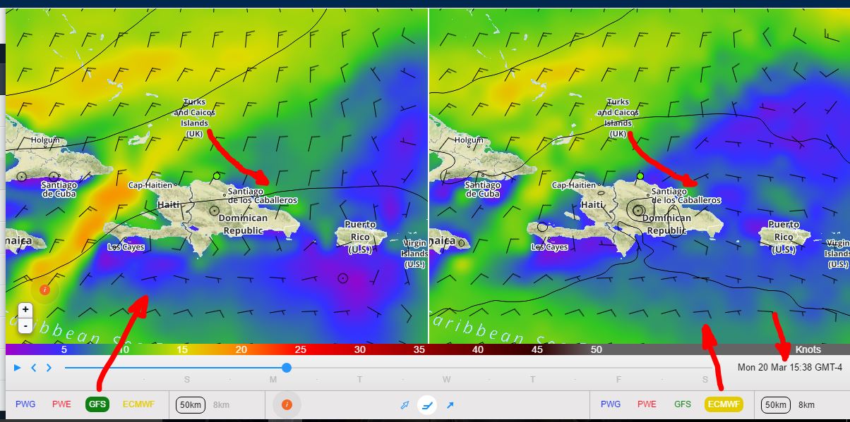
Yes you make 150+ miles a day, but you also have to listen to the engine. The nice aspect is that we took no waves or spray over the bow. The sea had a gentle roll of 2-3 feet maybe 10 seconds and the winds never changed for over a day. Then on day two, as forecasted, the wind shifted in a matter of minutes and built to a solid 10-12 knots. It was at this time we finally killed the engine and sailed about 6 hours into sunset and on into the night until around midnight when we turned towards Samana.

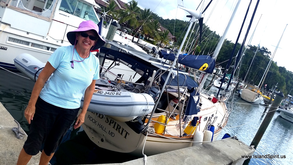
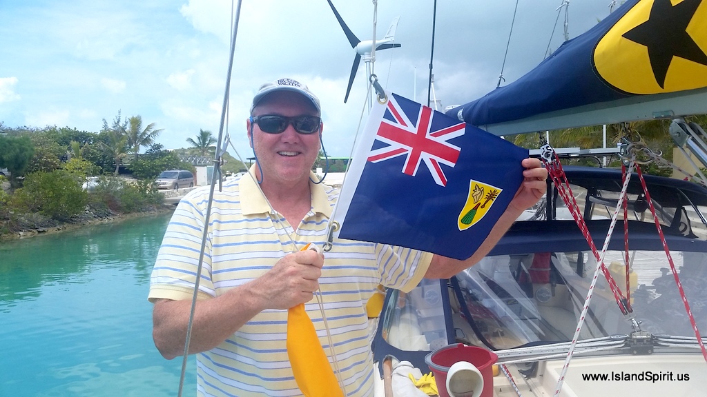
Hayden raises the DR flag

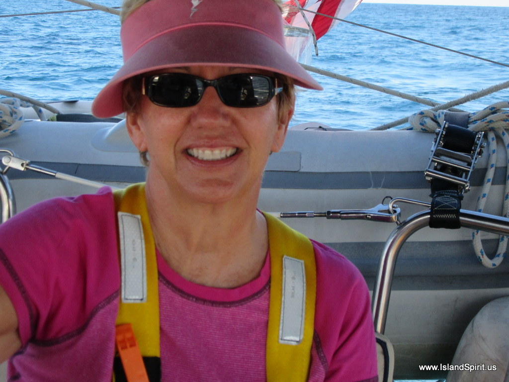
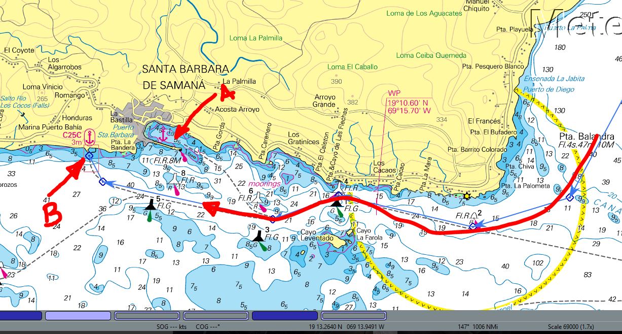
There we pulled into the harbor and dropped the hook and crashed. The next day we up anchored at 0630 to get out of the harbor and move around to the marina where we could check into the country properly. Checking in took about 1-2 hours with paperwork and boat inspections and re-tying the dock lines to keep the boat off the fixed concrete docks. We were thrilled to lower the yellow Q flag and raise the DR flag. Right after that, we crashed at around noon. When we got up and walked off the boat, we all felt like we were drunk as we had not been on land for nearly 3 days. Our balance was whacked and we almost fell off the dock just trying to walk off the finger pier. But a few happy hour drinks by the pool and some great times with out team of six made the evening a blast.

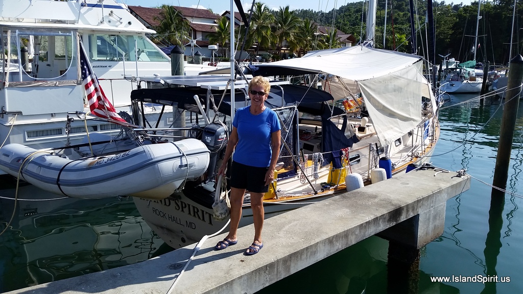
Radeen gets to land and is wobbly
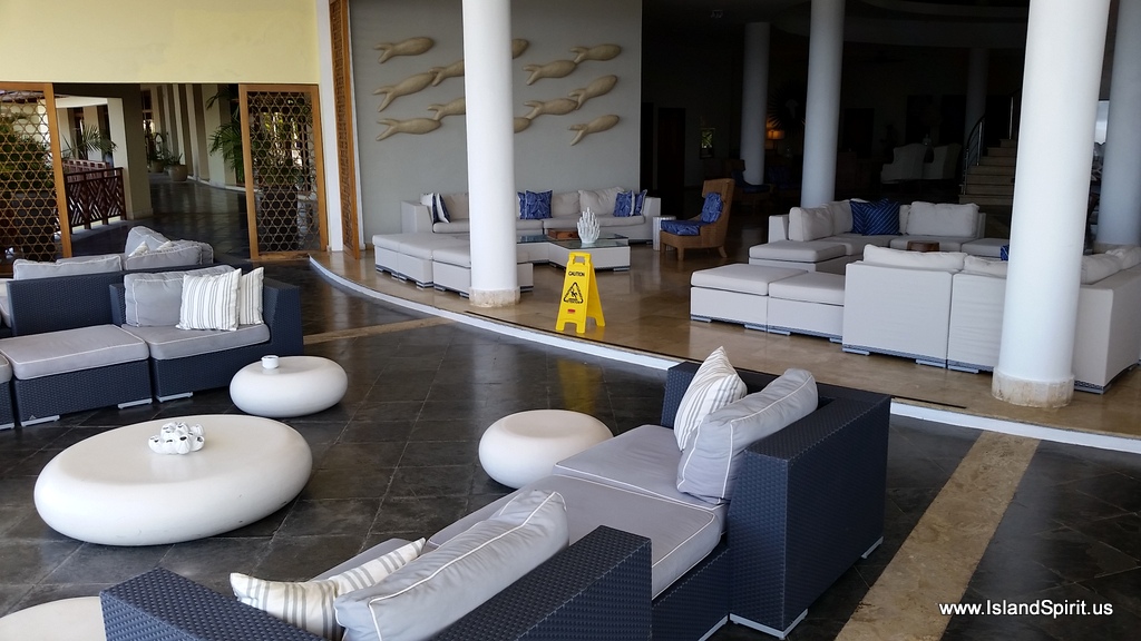
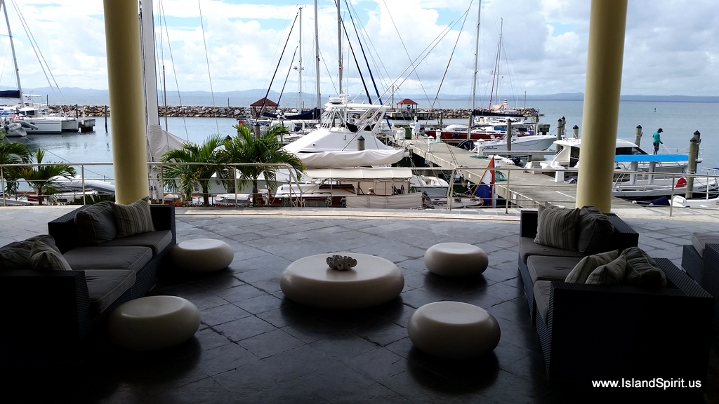
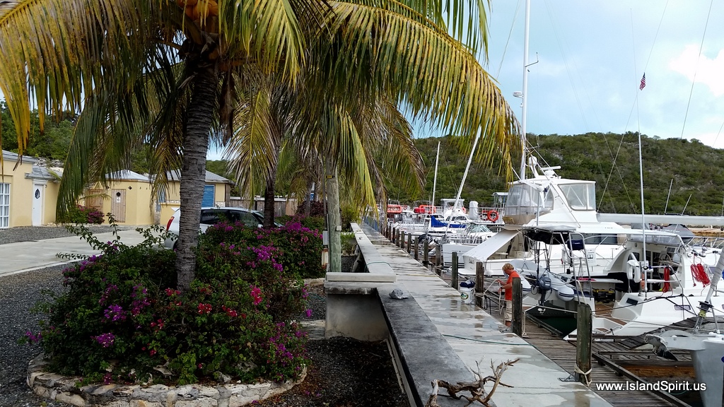
This marina is part of a five star resort with a hotel and condos overlooking the harbor that sell for $300K to $500K. There are comfortable sofas and lounges over looking the marina docks. This is really an amazing place and at a fantastic price. Look at this photo below, this is the lobby overlooking our dock. Beautiful setting!

Marina lobby overlooking our dock

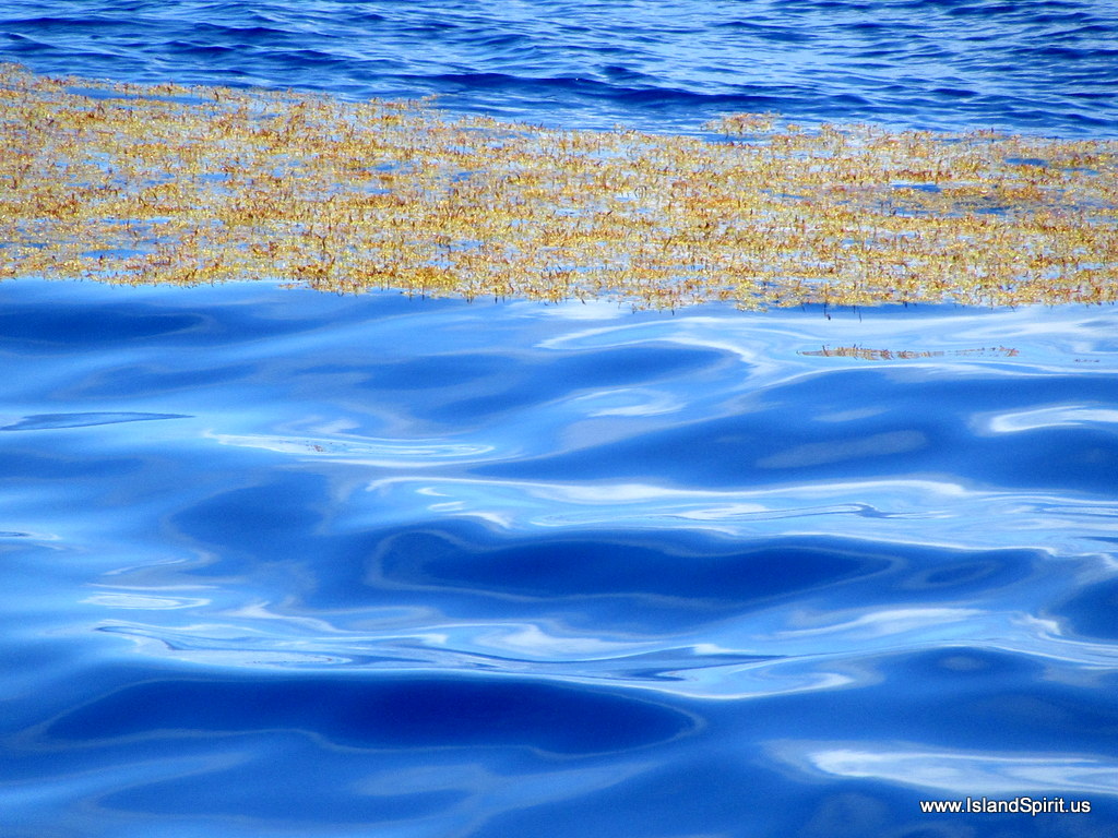
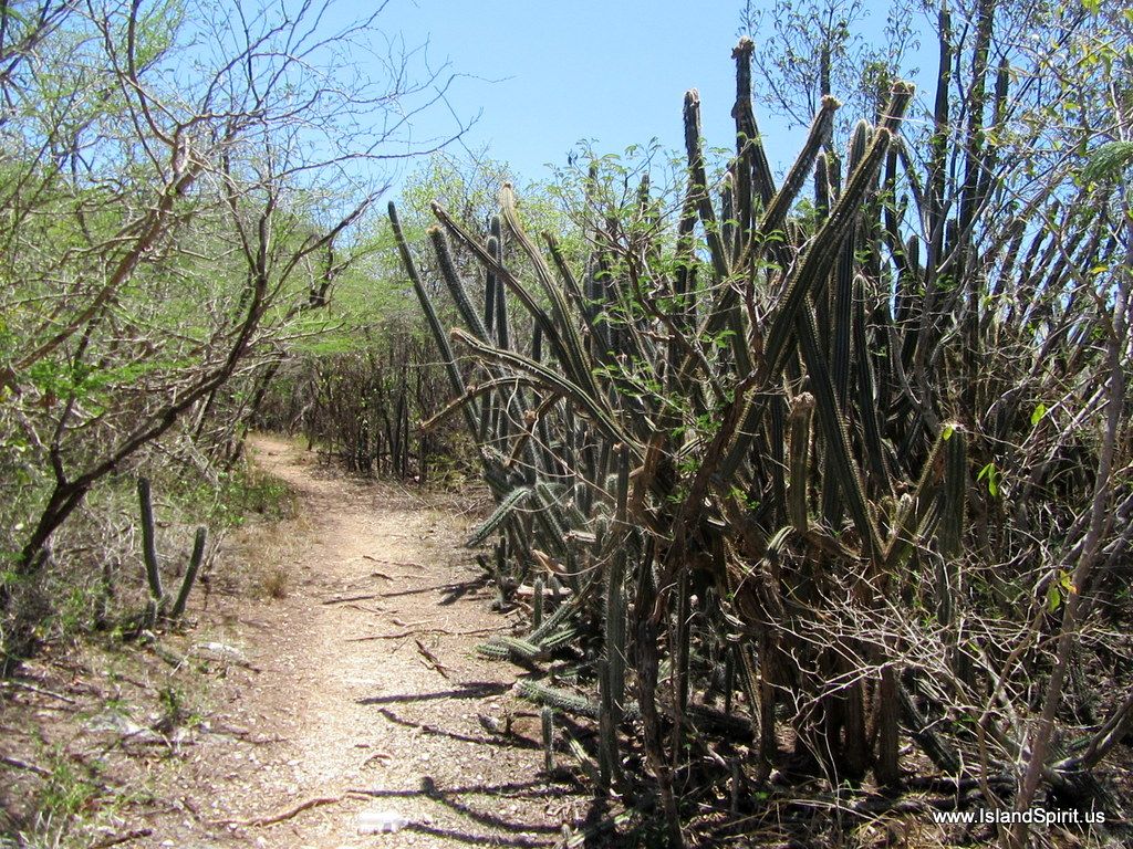
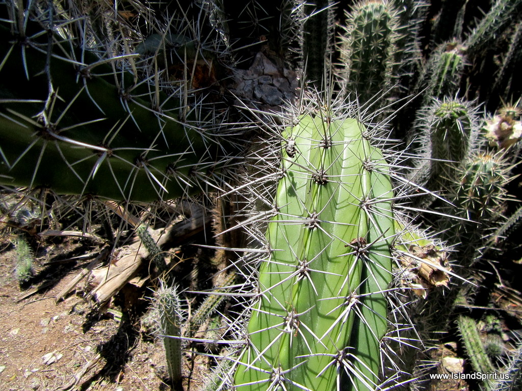
These are real tropical rain forest leaves
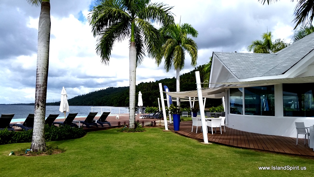
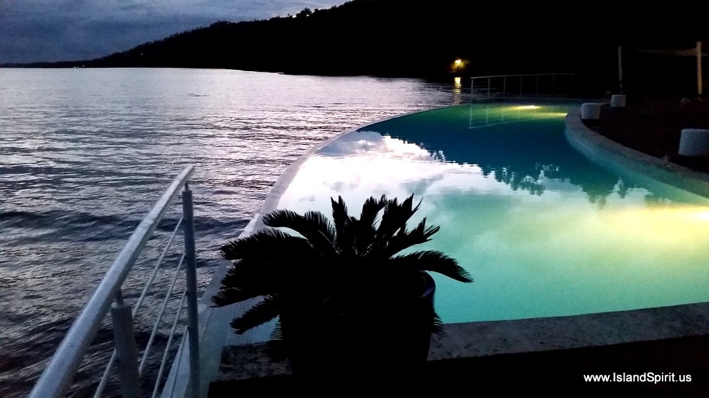
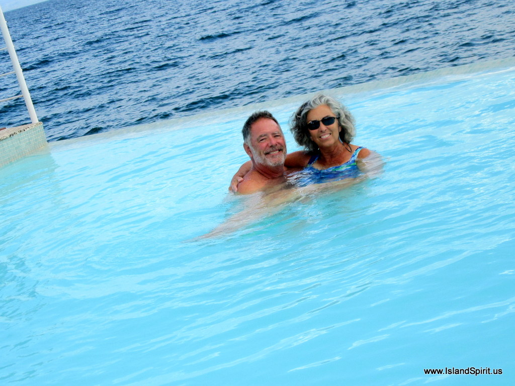
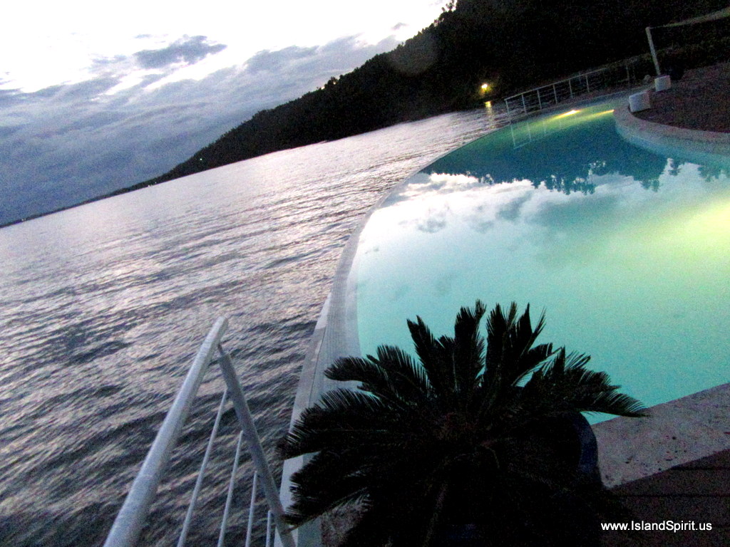
Then there is the infinity pool that curves gracefully at the water’s edge with a cafe and bar just off the pool deck. The staff is like any good all inclusive resort, very attentive and always there to offer you a drink and make you feel at home. We are swimming in this pool every day, it is simply too beautiful.

Our facilities tour and we discover the pool

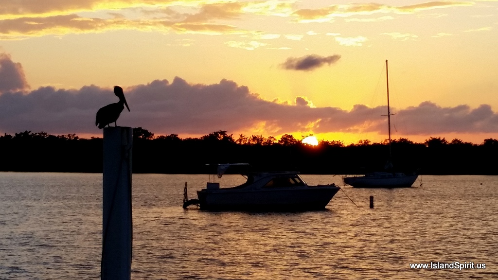
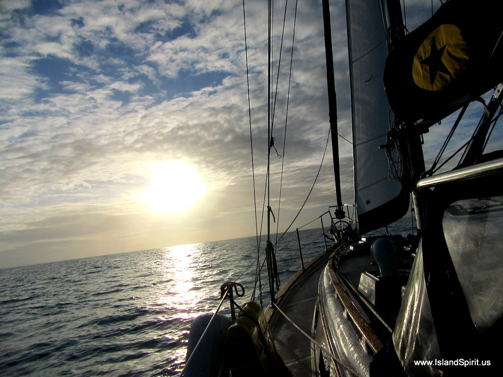
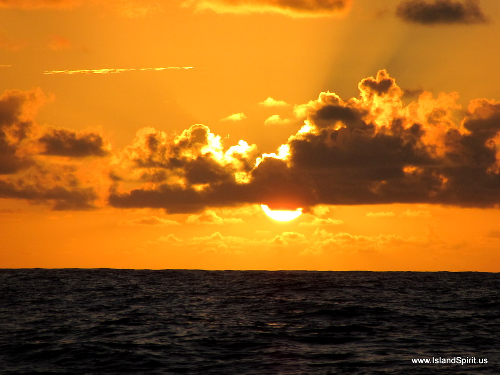
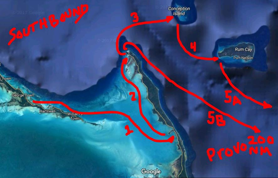
Our passage to the DR was so calm and so easy, we simply motor sailed 80% of the trip in 5-8 knots of east winds. Then on the second day the wind came up and shifted and we sailed nearly the rest of the way into the country. Look at this sunrise photo on the day we departed Turks and Caicos.

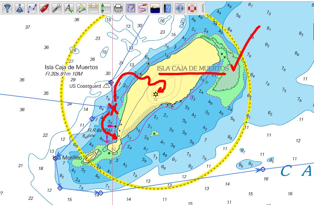
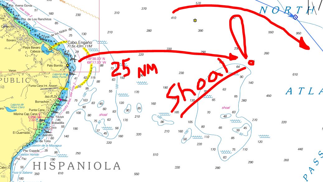
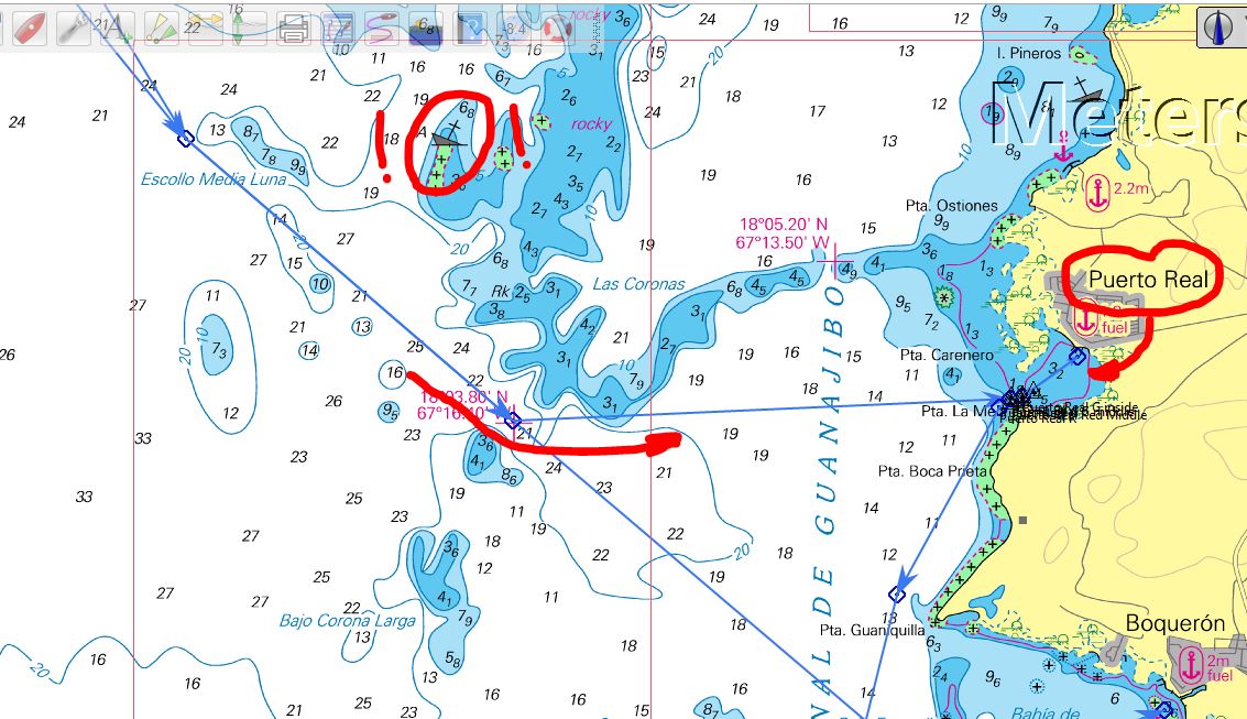
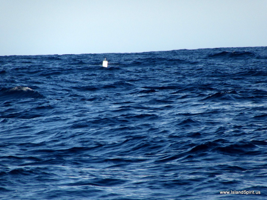
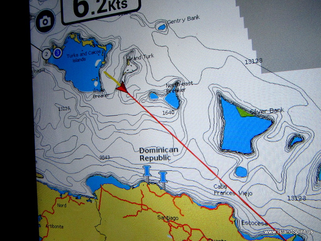
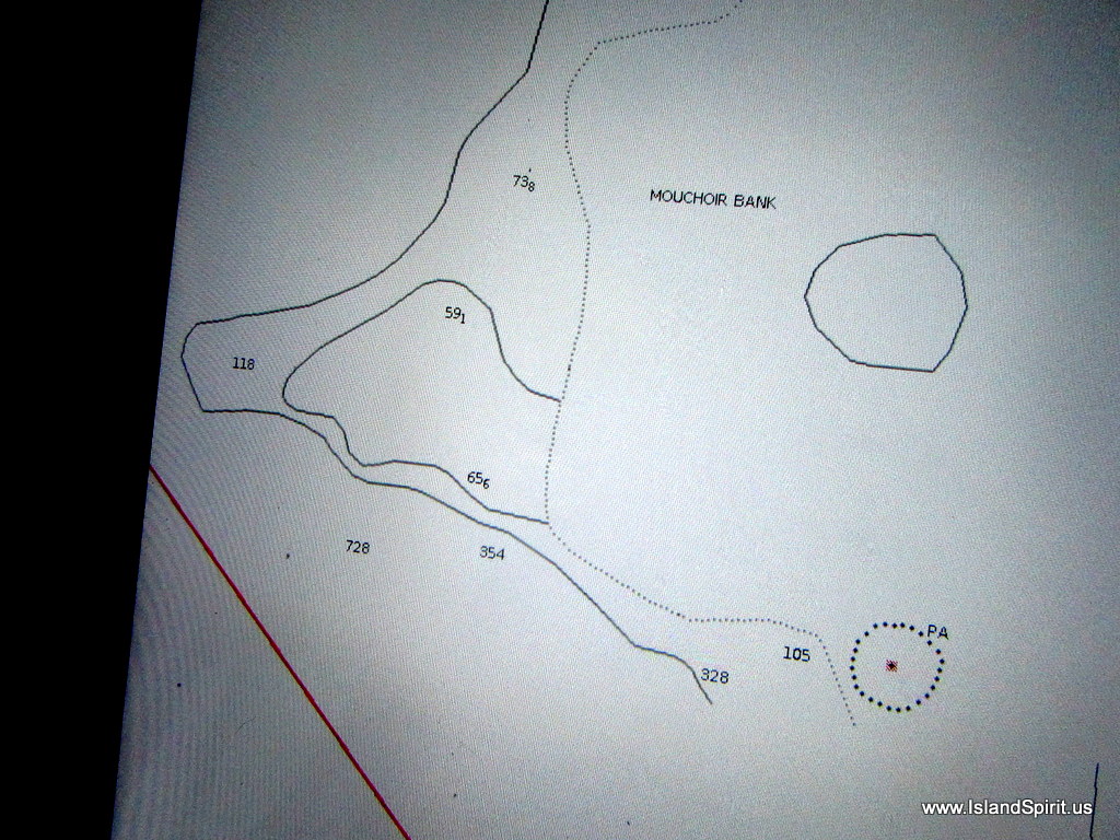
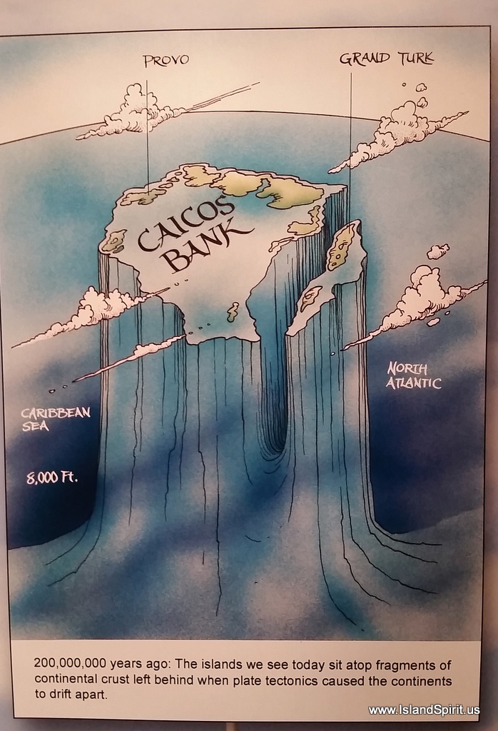
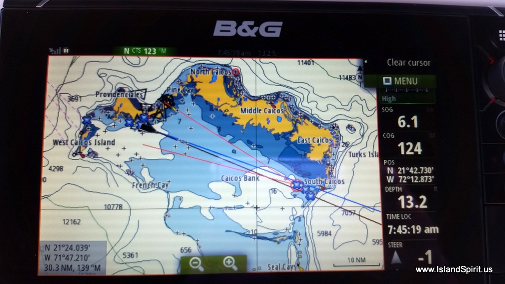
One of the things we learned is that there are shallow banks that you need to pay attention to out here in the middle of the ocean. We are in thousands of feet of water and then there comes a sand bar island….oh….that is Big Sand Key. Well, who put that in our way? Go around that. Then south of that you have the Mouchoir Bank that rises up from 14,000 feet deeo up to 50 feet and yup, it has a ROCK that you can wreck you boat onto. So, find that and divert around that as well. Look at these chart images and you will see these features.

The shallow banks

TherMouchoir Bank

Oh, look a ROCK on the Mouchoir bank! YIKES!
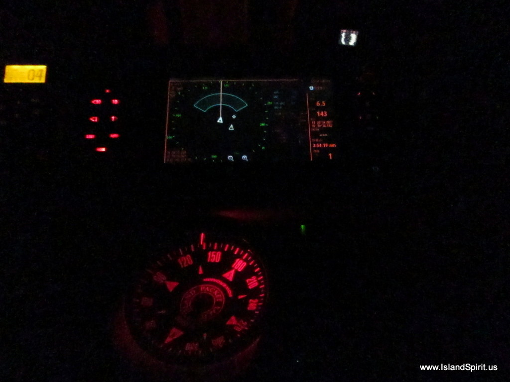
When running at night, full speed ahead is always stressful and you really have to trust your radar system. That is why we think radar is number one at sea at night. It is the only tool that will tell you there is nothing in front of you that is solid, on the surface, that you could hit. So, you keep scanning, looking and you press on full speed into the blackness. This really takes some time to get comfortable with, but once you are, it actually is easier to be at sea at night that it is at day. There is simply nothing to see, so you just look at your radar screen. Here below is the view from the helm at night looking forward.

The view from the helm at night
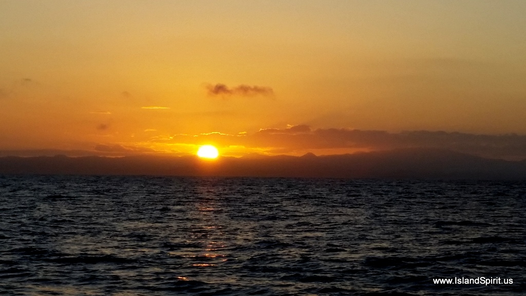
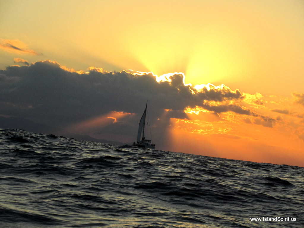
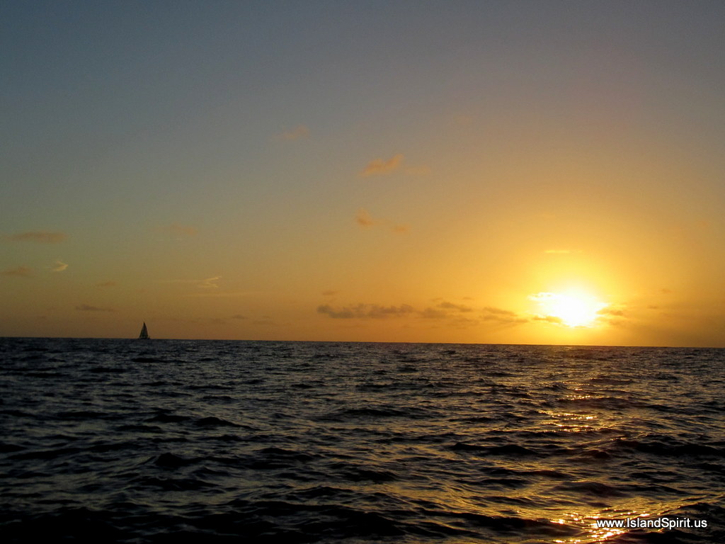
Then the sun rises and all seems fresh and new again. Put on the coffee, make some breakfast, wake up and refresh, the day is starting and your ship is pressing onward. Day after day after day and you eventually reach the destination. This was our sunrise on day two.

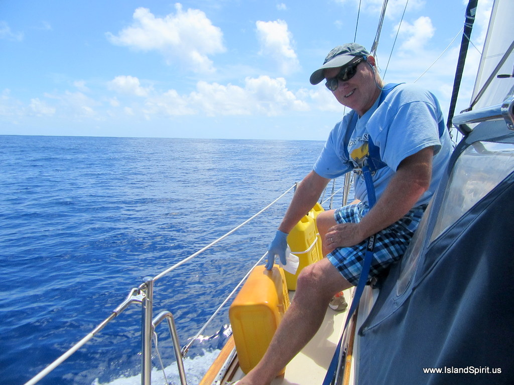
With all the motoring and the long distance, we decided to pour in three more jugs of fuel just to keep the tank more full than empty. Our tank’s motoring range is about 350 nm and this was only 250 nm so we were in no danger of running out. So, in this calm sea we easily could pour the fuel into the deck fill as there was no seawater running down the deck. Here is Hayden adding fuel.

Finally, LAND HO….there were the Dominican Republic mountains under our jib as we sailed into the new winds that finally arrived. This was a sight we have never seen, tropical tall mountains under our own sails as we arrived from sea. We have sailed in Blue Hill Bay, Acadia Maine but even that does not look like this. This is tropical and it felt very cool.

Welcome to the Dominican Republic and Puerto Bahia Marina…..

Don and Meloney one of the infinity pools
Radeen and Meloney

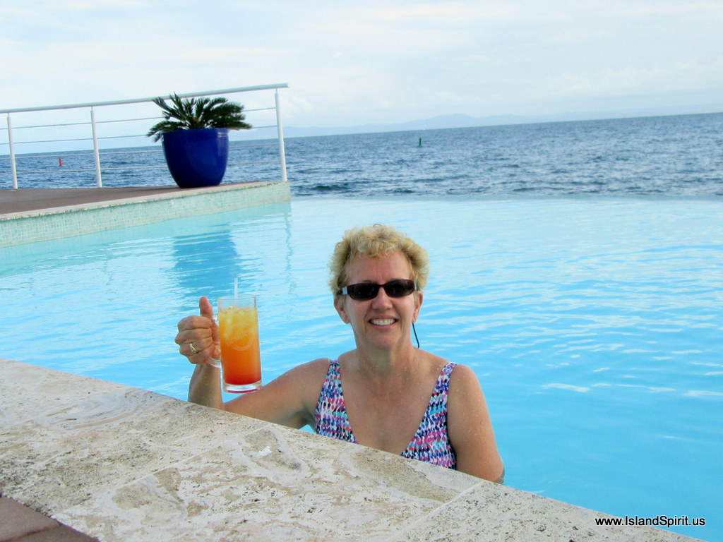
WHAT? Radeen with a celebratory adult beverage at the pool

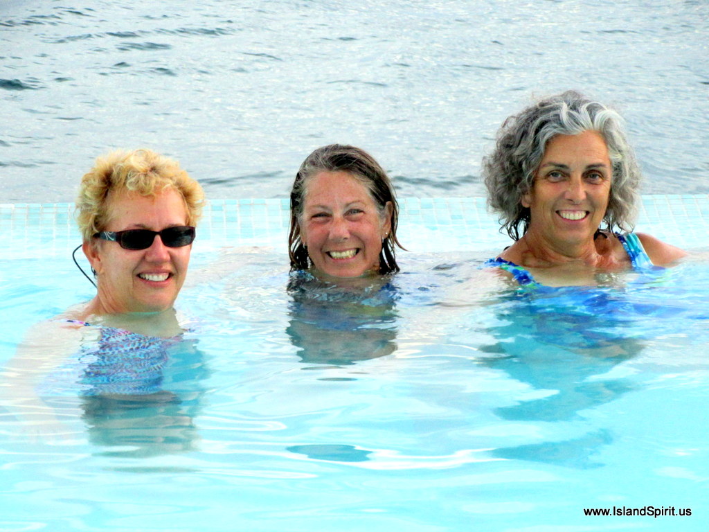
Radeen, Lauren and Meloney in the pool

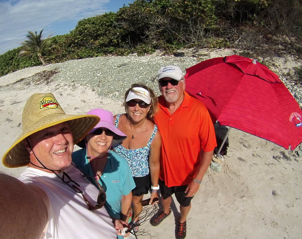
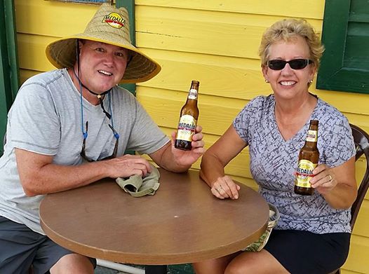
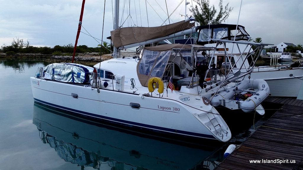
Here are the buddies we are running with. Bill and Lauren on Grand Banks 42 long range cruiser SEA STAR and Don and Melanie on a Lagoon 38 Catamaran FEZYWIG. Very fun people!

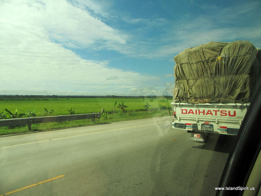
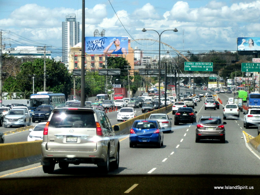
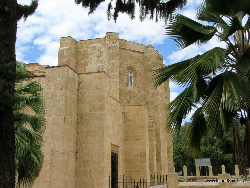
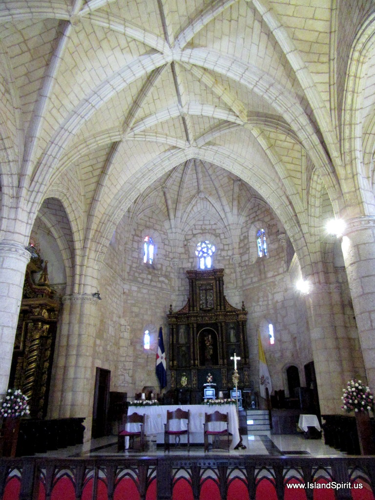
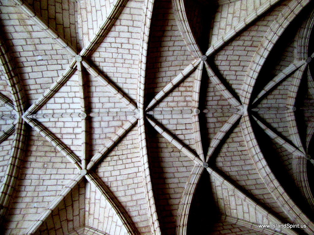
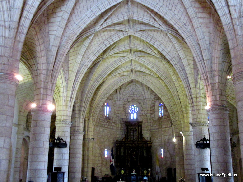
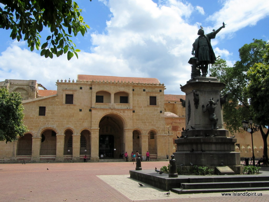
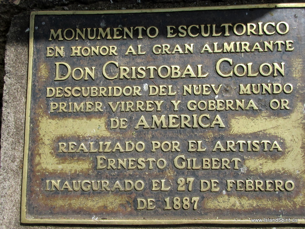
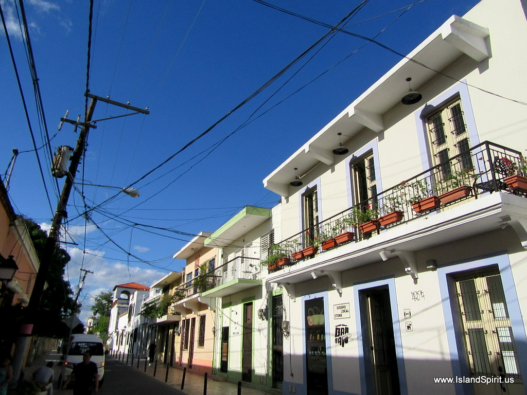
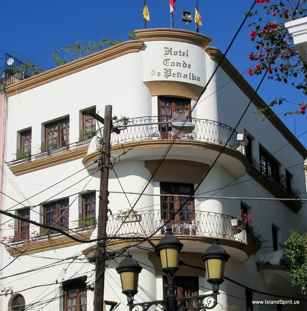
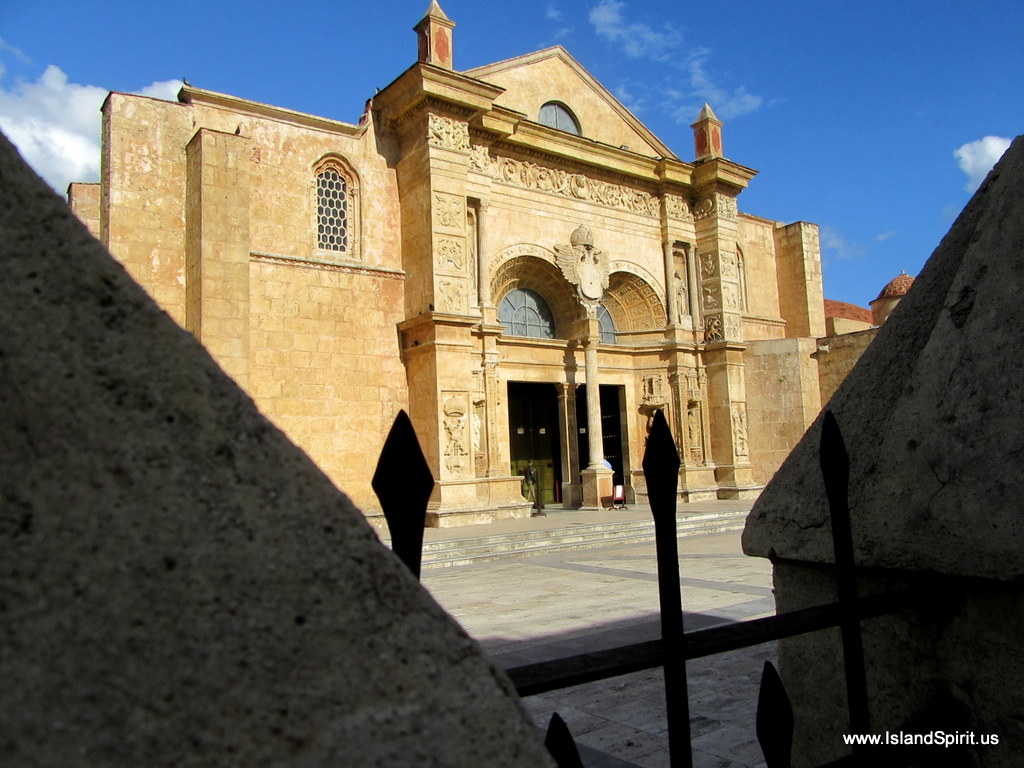
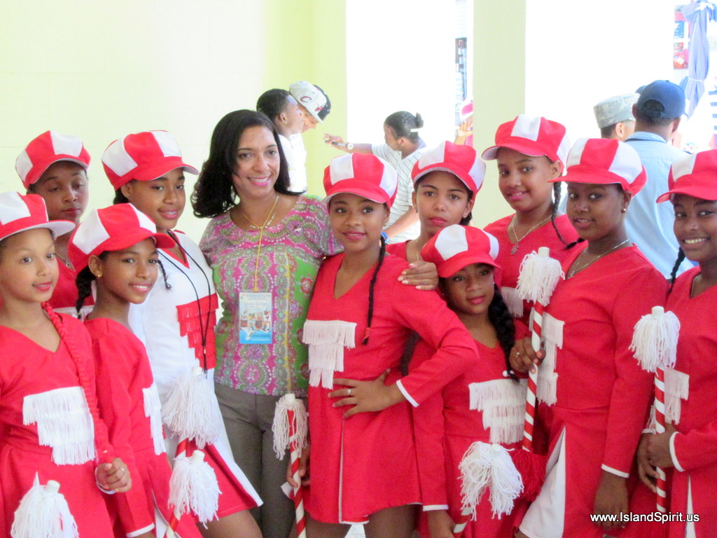
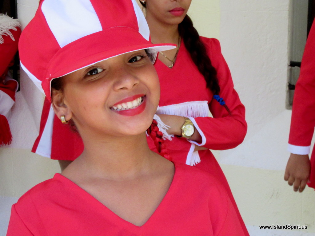
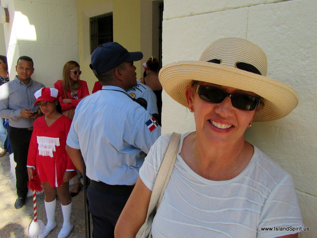
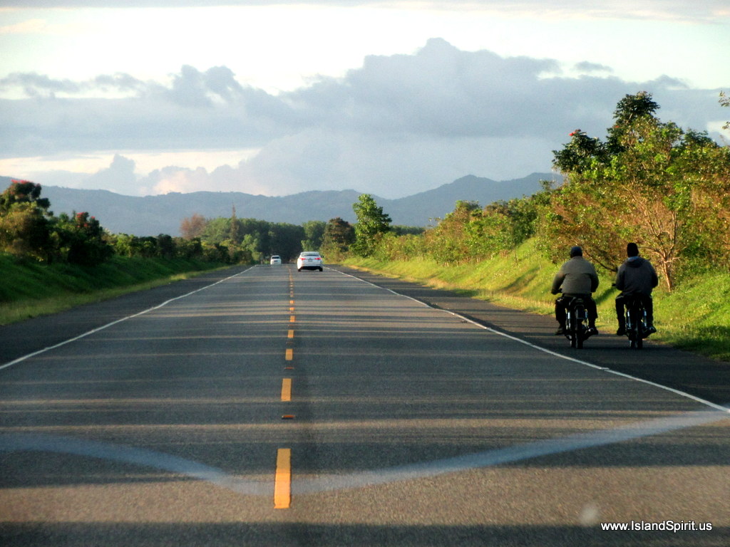
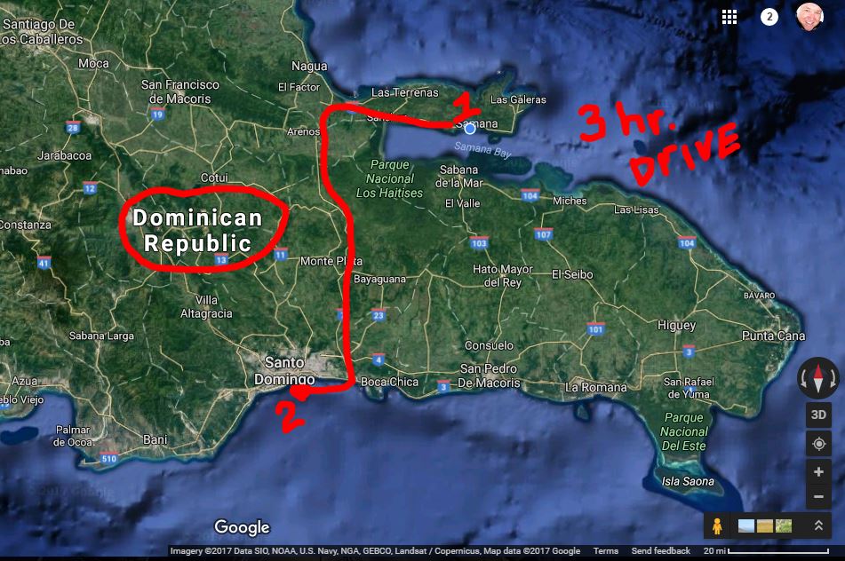
Tomorrow, we will tour the local town of Samana by local bus. The next day, we will drive a van 3 hours to the south shore to tour Santa Domingo, a UNESCO World Heritage Site. The Dominican Republic is a very interesting island to discover!

Provo to Dominican Republic

…Destination the DR. This map shows the entrance to Samana…

We are planning our next run from Provo, South Side Marina to Samana in the Dominican Republic. This trip is broken up into 3 main legs. The first leg is 40 nm to run the Caicos Banks and get to sea. The second leg is 27 nm southeast towards Big Sand Cay where we may drop an anchor for a few hours to time our next leg. The third leg is a 180 nm leg to Samana, Dominican Republic. We have several back up plans to divert short of Samana to other harbors in the Dominican Republic such as Rio San Juan or Sousa or Ocean World, if necessary.

We are fortunate to continue to travel with Meloney and Don from California, aboard a Lagoon 38 catamaran named “Fezywig” (a happy character in Dickens’ “A Christmas Carol”) and Bill and Lauren from Canada on a Grand Banks 42 trawler named “Sea Star.” Our boats are surprisingly similar in speed and depth. These lively and interesting new friends are a lot of fun. We are delighted to be able to plan our passages together. Many minds are better than one!

As much as we are enjoying Provo and especially South Side Marina, we must leave! This is a very good weather window because the prevailing easterly trades have stalled. The winds are looking calm, 10-15 knots or possibly less. We most likely will need to motor sail to keep the speeds up to make the destination within the weather window. This often seems to be the issue. We wait for weather to be calm enough to go to sea, but then we are usually running before a front which pulls all the air into the approaching front and takes away the winds. Then the frontal system will arrive and we are trying to beat that arrival by getting to our destination before the front hits with squalls and much higher veering winds. It is really a speed, time and distance challenge. This trip is 247 nautical miles and, at 5.5 knots it will take 45 hours. Now we need to plan a stop into the trip to arrive DR in daylight (for visibility) and in the morning (for the lightest winds). We will use Big Sand Key as a stopping point to make the timing work out. If all goes as planned, we will depart Sunday at 0700 and arrive Samana, Dominican Republic, Tuesday between 0800 – 1100.

Here is the route on OpenCPN, showing our 5 legs and the mileage for each on Sun, Mon and Tues.

Using OpenCPN and NVCharts we can plan routes, distances and times on the laptop

Here are some Predict Wind planning images:

The winds for our Sunday morning departure as we run the Caicos Banks to sea

Monday shows favorable winds all day as we run SE towards the DR

Remember, we are running a live tracking map by Garmin InReach. You can check out where we are at any time. https://share.garmin.com/IslandSpirit

Blue shows our routes since November 2017 and red shows this next passage.

Thank you for sailing along…..

Turks and Caicos

…clearing in to the Turks and Caicos…

We sailed into the Turks and Caicos after a great overnight passage from Clarence Town, Long Island, Bahamas……

The approach to South Side Marina near Provo felt a bit scary in the morning light, knowing there were coral heads everywhere, but not being able to see them clearly due to cloudy conditions. Our four days here flew by, with boat jobs to complete and one great day of sightseeing and provisioning. This country is world famous for its underwater opportunities, so we were disappointed that we could not go snorkeling or diving due to the high winds, cloudy skies and storms which arrived the day after we did.


Lucky for us, the dinghy was in the perfect location for repairing a small leak in the stern of her port tube.

Sunset from Bob’s Bar, with a powered hang glider zooming over the marina.

We replaced the impeller after Radeen-the-Diesel-Whisperer thought the engine sounded “hollow.” She has been right on two occasions in the past, with broken blades discovered upon inspection. Not this time, however.
To quote the famous lyrics, “Two outta three ain’t bad.”

Ready for sightseeing in a rental van with 3 other boats.

Our first stop of the day was at the Caicos Bakery for good coffee and delicious pastries made by French bakers.
So civilized!

Igloos?  In the Turks and Caicos?! The primary export of the Colony was salt. When a drawing was sent to England for making the first flag, an artist interpreted the piles of salt as igloos!! (Note the doors on those igloos.)

Remarkable topography 6,000 ft. from the ocean floor…The Caicos Bank is over 40 miles from east to west.
Grand Turk is the larger of the islands across the Turks Passage to the east. 

We thorough enjoyed the small National Museum, and were lucky to stumble up on it,
as it is onl yopen M- F from 9 a.m.to 1 p.m.

Our docent, Theresa Williams, with the crews of Jeannteau 45 Rascal (Michele and Charlie),
Grand Banks 42 Sea Star (Lauren and Bill) and Lagoon 38 Fezywig (Meloney and Don.

Theresa entertained us with stories of history and culture. 90% of the citizens are descended from the 192 people from the illegal slave ship Tourvedore which was shipwrecked trying to avoid British authorities. The captain and crew were arrested and the freed slaves were given apprenticeships for one year to learn how to harvest salt.

We toured the inside of this traditional thatched hut and interesting gardens of medicinal herbs and barks.

An adventure in dining al fresco in wind and rain on the north shore at the Conch Shack.

We were speechless at this bounty, after 6 weeks of limited shopping in the Exumas.

South Side Marina office and laundry room, with folding table.

A beautiful outdoor shower!

Floating docks and a beautifully maintained property.

Bob’s Bar on the left and Bob’s house on the right.

Our gracious host and marina owner, Bob Pratt, on the right,
who made us feel so welcome in this beautiful place he started 40 years ago.

Leaving Provo, heading ESE across the Banks.

Good-bye to the Turks and Caicos!
We have a good weather window again, so we planned our next leg of 240 miles with a 7 a.m. departure across the treacherous Caicos Banks. That means leaving the Banks by 4 p.m., passing Big Sand Cay by sunset and arriving in Samana, Dominican Republic, approximately 40 hours later. Thank you for following our adventure!

Video: Ocean Sailing to Turks and Caicos

We had a fantastic sail out of Clarence Town, Long Island in the Bahamas, 180 nm southeast to Providenciales (Provo) in the Turks and Cacios. We sailed the first part of this trip in 15-18 knots of close hailed conditions out to Acklins Island. With the sun rising we sailed into the rising sun and the water reflections were simply amazing. The sea state was 3-4 foot waves with many a bow wave crashing into the close hauled jib. Island Spirit sailed very well and we really enjoyed our New B and G NAC-3 autopilot which sails to wind vane steering very well. We simply stood watches and held on as we sailed. Here is a video I shot showing the scene. I hope you enjoy the ride. This is typical ocean sailing. Enjoy…

Remember, we are running a new Garmin InReach satellite tracking device which is recording map pins of every where we travel. This is building an archive map of our sailing. This is really fun to look at as well:
http://share.garmin.com/islandspirit 

Bahamas to Puerto Rico to Virgin Islands Southbound

…The Book on sailing south…

Radeen and I have studied Bruce Van Sant’s book “Passages South” and we have made the routes on our laptops and on our B and G plotter and Samsung tablet. We are excited to begin this new chapter in our cruising adventures, which means heading south from George Town, Exuma, to the Eastern Caribbean. We have been to Long Island before and that will be our staging point. The route is well planned by Van Sant and the concept is like this. (He calls his route The Thornless Path to Windward, instead of The Thorny Path. Let’s hope so!) Leaving Long Island and heading east and south, we will make our first major stop at Provo in the Turks and Caicos where we plan to check into the country at South Side Marina. We will spend time in Provo and then wait for the next weather window to run the 50+ nm Caicos Banks. We will anchor for one night at the end of the Banks. The next day we will run south to Big Sand Cay and then onto the Dominican Republic, known as the DR.

The Luperon Harbor
Many cruisers sail into Luperon, Dominica Republic. This is actually where Bruce Van Sant is building a home and we would like to meet him. We also have heard that it is not a very clean harbor but it is very inexpensive with mooring balls costing $40/month! We prefer our own anchor to any mooring ball as we know the strength our gear whereas we would not know the condition of a mooring ball gear.

The next option east is called OCEAN WORLD where we would need to take a dock. If you look at this map, you can figure out why they call this place “Motion World” as the east trades and swells come into this harbor as they bounce off the rock wall and reflect back into the marina. We also hear that is the swell is running then this can be a dangerous entrance. This is in contrast to Luperon where you can easily sail in and drop an anchor. We will need to study the swells before leaving Turks and Caicos and then make the call as to where to check in.

Ocean World Marina in the DR

Now that we will be in the DR, the next challenge is motoring east into the trade winds and the current. This is accomplished by motoring at night when the trade winds are blocked by the mountain down drafts, called Katabatic winds, off the DR coast. This makes a calm lee that reaches offshore 5-10 miles off the coast. So, we will motor east during the night and then when the trades kick back in around 9am, we will head back into shore and drop the anchor and wait for the nighttime lee. This leads us to Puerto Rico’s south shore heading east to the Spanish Virgins and then into the US Virgin Islands and onward to the British Virgin Islands. At this point, either this season or next, we will make a turn southward for St. Maarten and the Leeward Islands and then down the Windward Islands. We will haul out the boat and store it somewhere between Puerto Rico and Grenada for May 15 – November 1.

Here are some maps of these plans…

George Town to Long Island to Calabash Bay to Provo. Day hop to Conception (3) Rum (4) to Provo (5A) …. or make one 200nm run to Provo (5B).

Long Island to Provo (5B) or stop at Samana (6) and/or Mayagauna (7) then to Provo (8)

Provo, Turks and Caicos, to DR with a stop at Big Sand Cay (10) or nonstop to DR (10B)

The DR to Puerto Rico the USVIs and the BVIs (Option Play: store the boat in Puerto Rico in May)

The Virgin Islands and south, island hopping or making a full 2 day run.

 Options on this plan:

  • Store the boat in Puerto Rico, USVIs, BVIs or Antigua, Jolly Harbor
    • This will save time and allow us to explore more northern areas without rushing south
    • This will also allow us to start there next year
  • Or, simply take a WX window and sail over night for Grenada and store the boat there.
These are all in the plans, either way, the goal is to get the boat to the Caribbean Sea and base there for the next 4 seasons. From our view now at George Town, Exumas, here in March, we are thinking that we should store in PR and just do the USVIs, BVIs and Spanish Virgins this season, then start there next Nov/Dec. That is looking like the plan now. The risk with that is placing the boat on the hard in the Hurricane Zone and taking the risk of storm damages. That is what we are thinking of right now and we are not sure we want to take that risk again. We will see how far we get…
The overview map of this plan….
Radeen is one Happy Sailor Girl as we prepare our flags to sail to many new countries.